
Weirdos
Aviators get excited about things that probably cause non-pilots in the general population to roll their eyes. Obvious examples include an obsession with pancakes paired with a biological need to look skyward at the sound of any aircraft passing overhead. We indulge in endless debates about high wing versus low wing aircraft, taildraggers versus nose draggers, certified versus experimental, and the virtues (or lack thereof depending on one's point of view) of whole-airframe parachutes. There is also massive interest in landing our aircraft at unusual locations like the only FAA-recognized ice runway in the USA, the highest elevation public airport in the USA, diminutive islands in the Gulf of Mexico, or the very site where modern aviation truly began.
 |
| It looked like a good day for flying at Brunswick Executive Airport. |
Along these lines, Maine presents a unique opportunity for visiting pilots to land at the easternmost airport in the USA: Eastport Municipal in Eastport, Maine (KEPM). Add fresh seafood into the equation and the opportunity becomes an imperative. This is why Kristy, The Bear, and I launched from Brunswick on the morning of June 22 to add Eastport to our map of airports visited. It became airport #241.
 |
| Sectional chart depicting Eastport Municipal Airport (KEPM). |
From Tom and Alicia's 2020 visit to Eastport, I knew that downtown was roughly 1.5 miles away from the airport and that the airport manager would provide rides on request. Alternatively, loaner bikes were reputedly available on the field. I called the manager before departure and, failing to reach him directly, left a voicemail.
Coastal Survey
| Date | Aircraft | Route of Flight | Time (hrs) | Total (hrs) |
| 22 Jun 2022 | N21481 | BXM (Brunswick, ME) - EPM (Eastport, ME) - BXM | 3.1 | 2464.0 |

The first portion of our flight merely backtracked along the same route we drove on US-1 from Boothbay Harbor that morning. We crossed the Kennebec River and noted the decommissioned Carlton lift bridge in Bath that runs parallel to the newer structure now bearing the US-1.

Low clouds shrouded the ground in many places, adding atmosphere and intrigue to the view.
 |
| Construction ongoing at the Wiscasset Airport. |
The Wiscasset Airport (KIWI) was where I performed an emergency landing in 2020 due to rapidly rising cylinder head temperatures on Warrior 481's new engine. Significantly closer to Boothbay Harbor than Brunswick, Wiscasset would have been an ideal home base for the week were it not closed due to a complete reconstruction of the runway. From above, it was clear that the new runway was finished except for striping. Yellow Xs denoting the runway closure were easily visible from our cruise altitude of 3,500 feet.

We overflew the Sheepscot River where the town of Wiscasset is situated.

Wiscasset is home to Red's Eats that claims title to the "best lobster roll in Maine". That's a pretty bold claim. Is it hyperbole? Perhaps. We actually tested their product the night before and were favorably impressed. However, lacking the time or funding to sample all the lobster rolls in Maine, I am forced to take their word for it. The seafood stand is located at the eastern edge of Wiscasset on US-1 near where the highway crosses the Sheepscot River in the above picture.
 |
| A causeway for trains and the US-1 bridge cross the water on divergent northeast headings out of Wiscasset. |

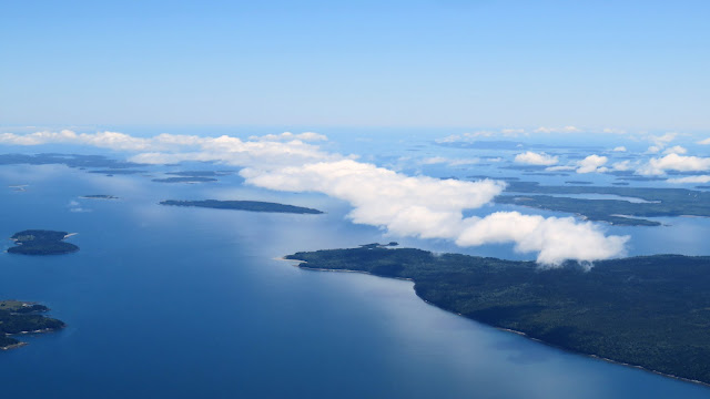
Our flight was quiet as we gawked at the stunning coastal Maine vista below.


Over Bucks Harbor near South Brooksville, the shape of Harbor Island caused me to dub the region "Broken Heart Bay". No offense intended to the fine people of South Brooksville, of course. My motivation for this name is purely geometrical.
Relay
Past the oddly-charted zone of "Special Military Activity" and approaching the Machias Valley Airport (MVM), I noticed that transmissions from Boston Center were becoming increasingly garbled. Realizing that we were losing radio contact, I keyed the mic.
"Boston Center, Cherokee Two One Four Eight One, we can cancel flight following."
There was a long moment of silence. Then we heard, "Cherokee Four Eight One, you're reaching the edge of my radio area, radar services terminated, squawk VFR."
I acknowledged only to have Boston repeat the request after another extended silence. Obviously, I could hear him, but he could not hear me. Fortunately, an airline pilot intervened.
"Boston, I can hear both of you and you're trying to do the same thing." With the airline pilot acting as an intermediary, we officially cancelled flight following with Boston Center and continued northeastward on our own.
The VLF: Very Long Flagpoles?
Filed under the category of "Things You Don't See Every Day", we passed the United States Navy's VLF Transmitter near Cutler, ME.

The VLF transmitter does not look like much on the sectional chart. It is depicted as a set of tall obstructions labeled "26 towers forming 2 stars". The tallest towers are about 1,000 feet tall. There are no airspace restrictions associated with the area around the VLF, so I decided to take a closer look.
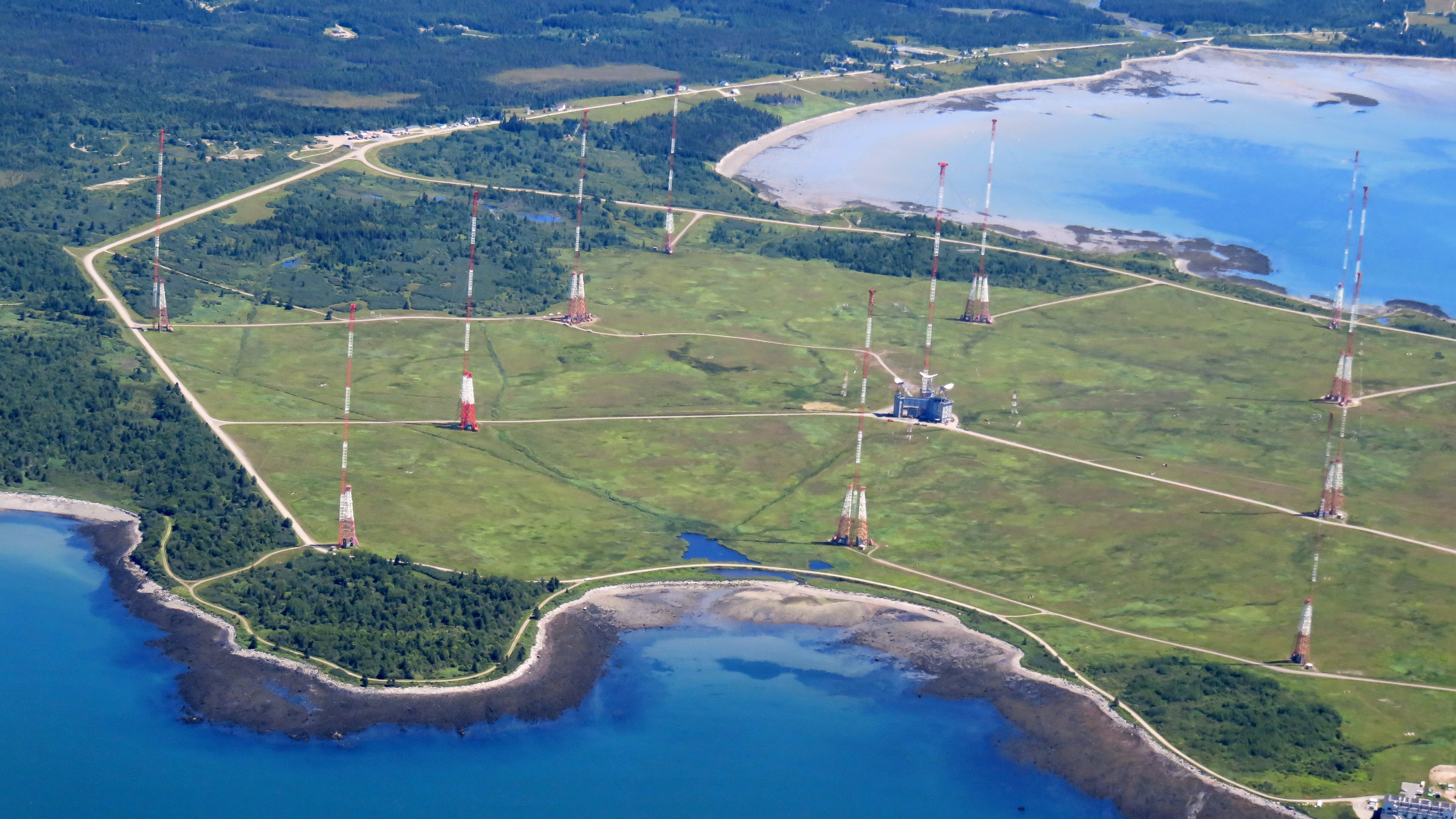 |
| The North VLF Array |
The VLF (very low frequency) transmitter sits on a 3,000 acre peninsula near Cutler, ME. Completed in 1961, the 1.8 megawatt transmitter is one of the most powerful in the world. Broadcasting at a meager 24 kHz, the resulting long wavelength RF can penetrate seawater to a depth of 30 to 100 feet. The Navy uses this antenna array to communicate with submarines operating on the surface or submerged in the Atlantic and Artic Oceans. Inherent to the very low frequency used, bandwidth is low and communications are limited to coded signals only. The system does not support audio transmissions.
 |
| The South VLF Array |
Given its location, the transmitter was built to withstand icing (up to 1.5", but it also has deicing capability) and high winds (up to 175 mph). It consists of two arrays of 13 towers each that can be operated independently. This allows one array to be in use while the other is undergoing maintenance or deicing.


Oooo! Lobster traps. I suddenly realized that I was hungry. Fortunately, Eastport was close.
 |
| A close-up of the south array's central antenna tower. |
Having satisfied my curiosity about the VLF array, we turned northeast to Eastport.
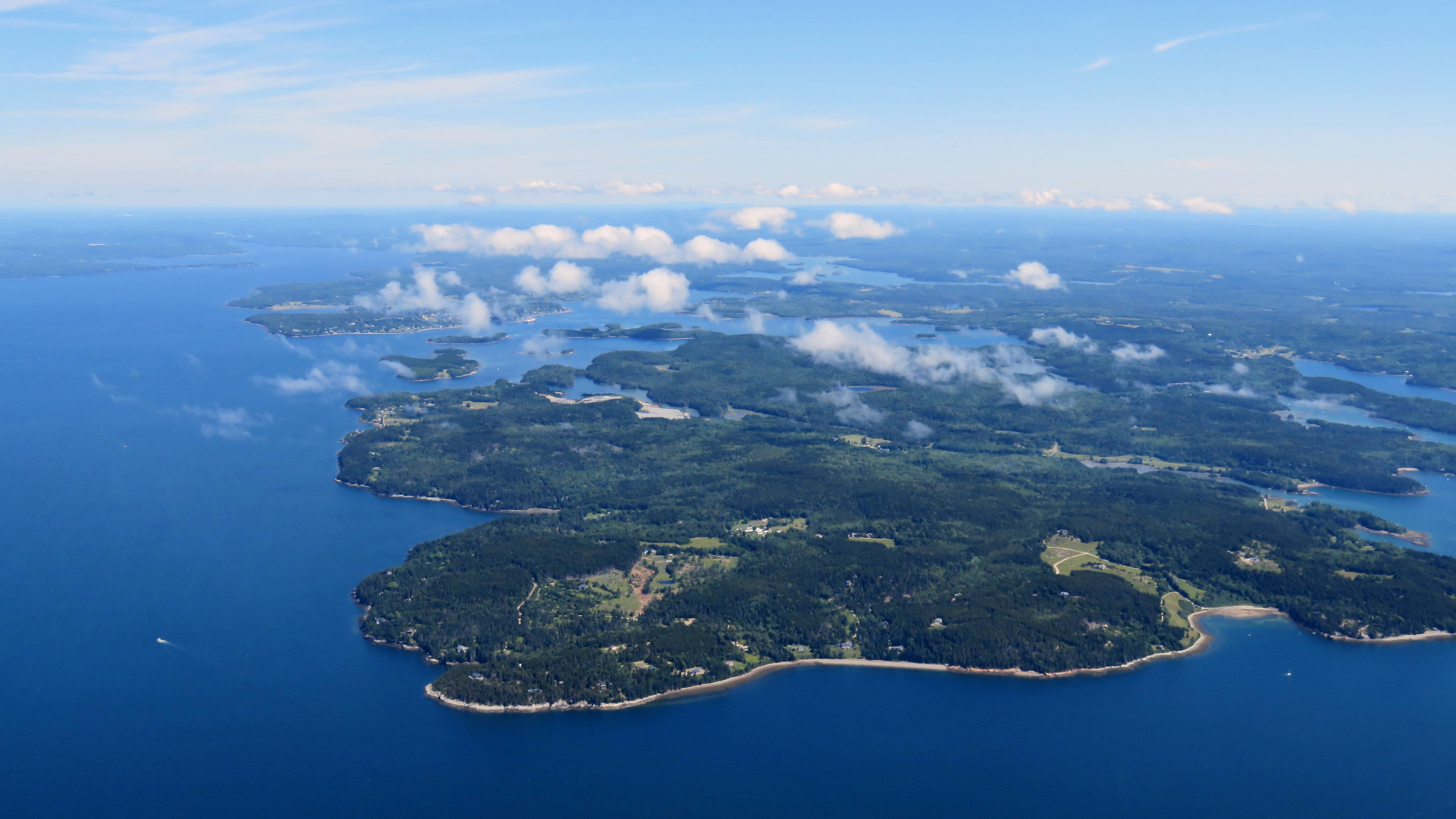
Spitting Distance from New Brunswick
 |
| Moose Island with Eastport Municipal Airport visible. |
Eastport is located on Moose Island and lays claim to being the easternmost city in the United States (nearby Lubec is the easternmost municipality) as well as the least populous city in Maine. Regardless of how one splits semantic hairs over the meaning of "city", the Eastport Airport is unquestionably the easternmost public use airport in the United States.
 |
| Eastport Municipal Airport. |
Less than a mile east of Moose Island and across the water of Passamaquoddy Bay are Campobello Island and Deer Island, both a part of Canada's New Brunswick province. While flying a left downwind pattern leg to runway 14, it is wise to be cognizant of one's proximity to the Canadian border. Out of deference to the tight airspace, I chose to enter the pattern on a left crosswind leg from the southwest rather than an extended 45° to the downwind from the east. The latter would have put me in Canadian airspace and that would have been wholly inappropriate as Canadians don't believe in 45° pattern entries!


 |
| Flying a tight left downwind leg for runway 14 at Eastport. |
 |
| Photo by Kristy. |
We made it! Our family landed at the easternmost airport in the United States!

We parked next to this absolutely gorgeous vintage Cessna 195.
The airport manager never returned my call, so we made our way to Eastport's diminutive terminal building. Inside, we met an older pilot and I asked about options for getting into town.
"Well, I don't think that the bikes are here anymore, but I'm heading that way and can drop you off. I just can't bring you back." It was the best offer on the table, so we took it. Along the way, he explained that he based a Cherokee at Eastport. After many years of flying to Eastport from Massachusetts, he relocated to Eastport permanently with his wife after retirement only to lose her to cancer a year later. He had lived year round in Eastport for about a decade.
Our benefactor dropped us off in front of the WaCo Diner and wished us well. I shook hands with him and exited the car, belatedly realizing that I failed to get his name.
Long Traditions
When Tom and Alicia visited Eastport in 2020, they enjoyed fresh seafood from Quoddy Bay Lobster, a local seafood wholesaler with a small retail stand right on the pier. From their description, it sounded very similar to a "fresh from the boat" kind of place like the Menemsha Fish Market that I visited on Martha's Vineyard.

Unfortunately, Quoddy Bay Lobster sold out to Look Lobster earlier this year. Look Lobster is another seafood wholesaler operating in the region, but as of our visit, they had not reopened the fresh seafood stand on the former Quoddy Bay Lobster property.
I identified the WaCo Diner as the next best option and the local Cherokee pilot agreed. Established in 1924, the WaCo claims to be the oldest restaurant in Maine. Much to my disappointment, the name is not a reference to the magnificent biplanes manufactured in Battle Creek, MI, but rather to diner founders Nelson Watts and Ralph Colwell.

Dr. Zoidberg brought out the claws for this touristy picture. Uncle Stephen, are you paying attention?

In commemoration of flying as far east as possible without crossing an international border!

WaCo Diner was a good find with a nice outdoor seating area in view of the bay. Kristy had fried shrimp and I had a crab roll. The Bear had a hamburger or, as I like to call it, Lobster of the Prairie. Everything was good and the staff was friendly. The land visible behind Kristy is Campobello Island in New Brunswick. Canada really is that close!

A stiff wind blew in from the bay and I was fascinated watching the gulls working the kinetic air, making subtle angle of attack adjustments to their wings to hover nearly stationary in space.

Whenever a gull alighted gracefully on a nearby railing, I realized that my clumsy ability to harness the air with my airplane is utterly amateurish by comparison. These little birdbrains are the true masters of the air!
As Far Down East as You Can Go!

Today's Eastport is probably a shadow of its former self. Purportedly the deepest port on the East Coast, the city has a history of ship building and was second only to New York City as a trading port in the 1800s. That is quite a claim for someplace so remote relative to the rest of our nation.


While many of the structures had obviously been lovingly restored, some along the waterfront were visibly abandoned and deteriorating.

It's faint, but the limestone over the main entrance reads, "1882, Frontier National Bank"

A former television prop stands in Eastport, transformed into an unlikely memorial for a New York City fireman.

A plaque at the base of this striking statue reads, "This statue was built in 2001 for Fox Television's filming of its reality mini-series, Murder in Small Town X. Restored in 2005 with donated funds and services, the statue is now a tribute to Angel Juarbe, Jr., the New York City fireman who won the $250,000 grand prize in the mini-series and soon after lost his life as one of the first responders to the World Trade Center attack on September 11, 2001."

Of course a Little Free Library in Maine has a widow's walk! "I don't know any of these books," proclaimed The Bear after peeking inside.

This 2015 statue of "Nerida, the Eastport mermaid" graces the rocky shore. The sculpture is occasionally the recipient of bikini tops from cheeky locals.


Does Nature's Grace describe the statue (which depicts a sail, a leaf, and a fish) or the demure Little Bear lurking behind it? Really, it's anyone's guess.

We saw this striking figure of a flute player as we embarked on the hike back to the airport.


Purple fields of lupine added character to the Eastport terrain. This vista of Passamaquoddy Bay somehow reminded me of Alaska's Inside Passage.

The walk back to the airport was not overly strenuous and while the shoulders of the roads were not very accommodating of pedestrians, every driver courteously gave us lots of space and most passed by with a friendly wave. In these small ways, I appreciated the slower pace of life in Eastport. It seems like maybe the Cherokee pilot who helped us that morning had chosen well.
Acadia and Beyond
 |
| A final look at downtown Eastport on departure. |
We launched on runway 14, initially buffeted by a turbulent oceanic airmass as it tumbled over the lumpy island on its way toward the continent.


We continued west along the coast, waiting for Boston Center to come back into radio range for flight following.


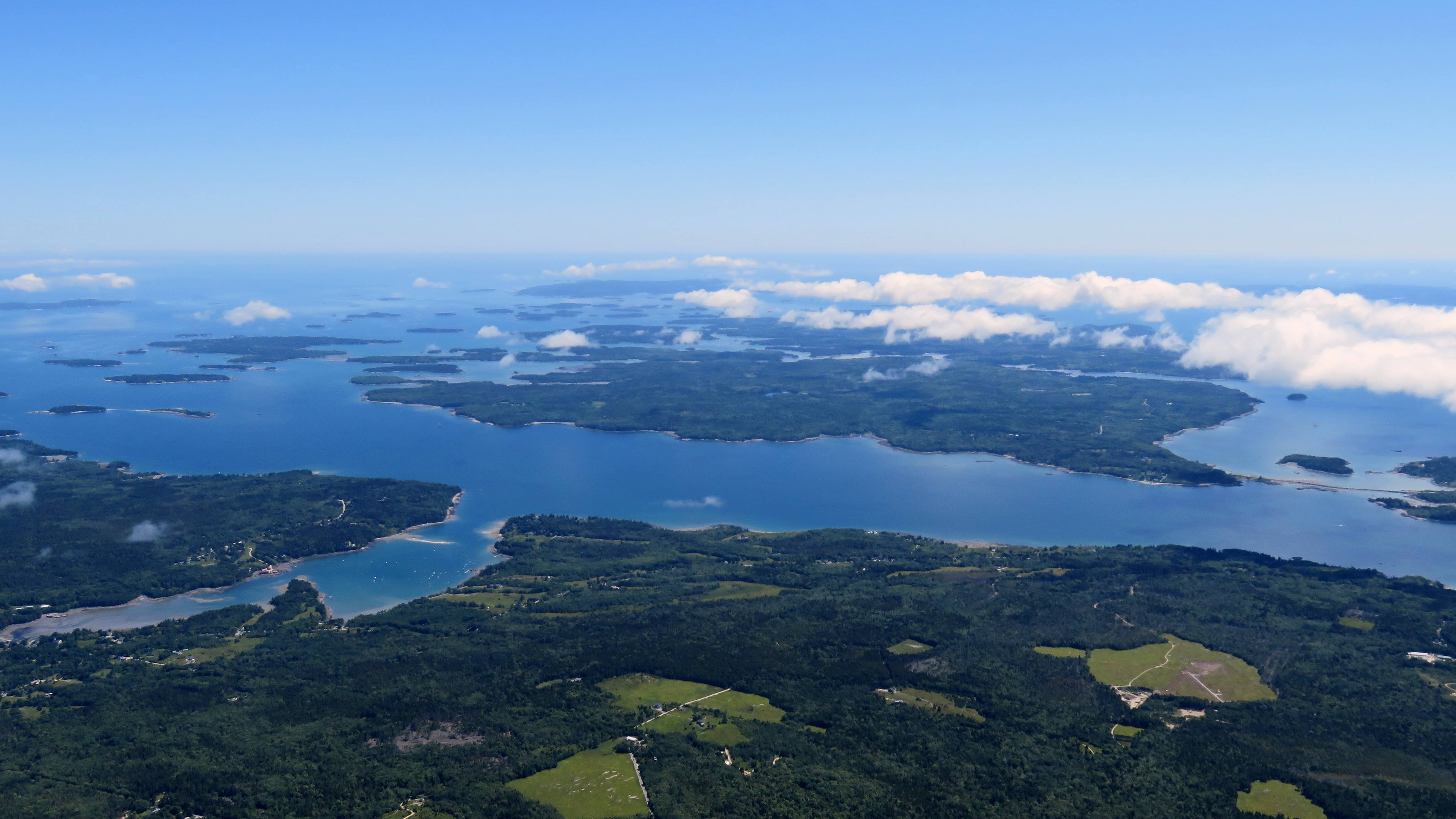
 |
| Frenchman Bay with Mt Desert Island to the upper right of frame. |
After 40 minutes of flying, we returned to familiar territory including Frenchman Bay and Mt Desert Island, home to Bar Harbor and Acadia National Park.

 |
| Mount Desert Island with Bar Harbor to the left of frame. |
 |
| Cadillac Mountain, Acadia National Park. |


What particularly caught my eye about this cloud formation was the way that its reflection on the ocean's surface created an ethereal halo around the islands.


 |
| The bridge from the mainland to Little Deer Isle and the causeway to Deer Isle. |


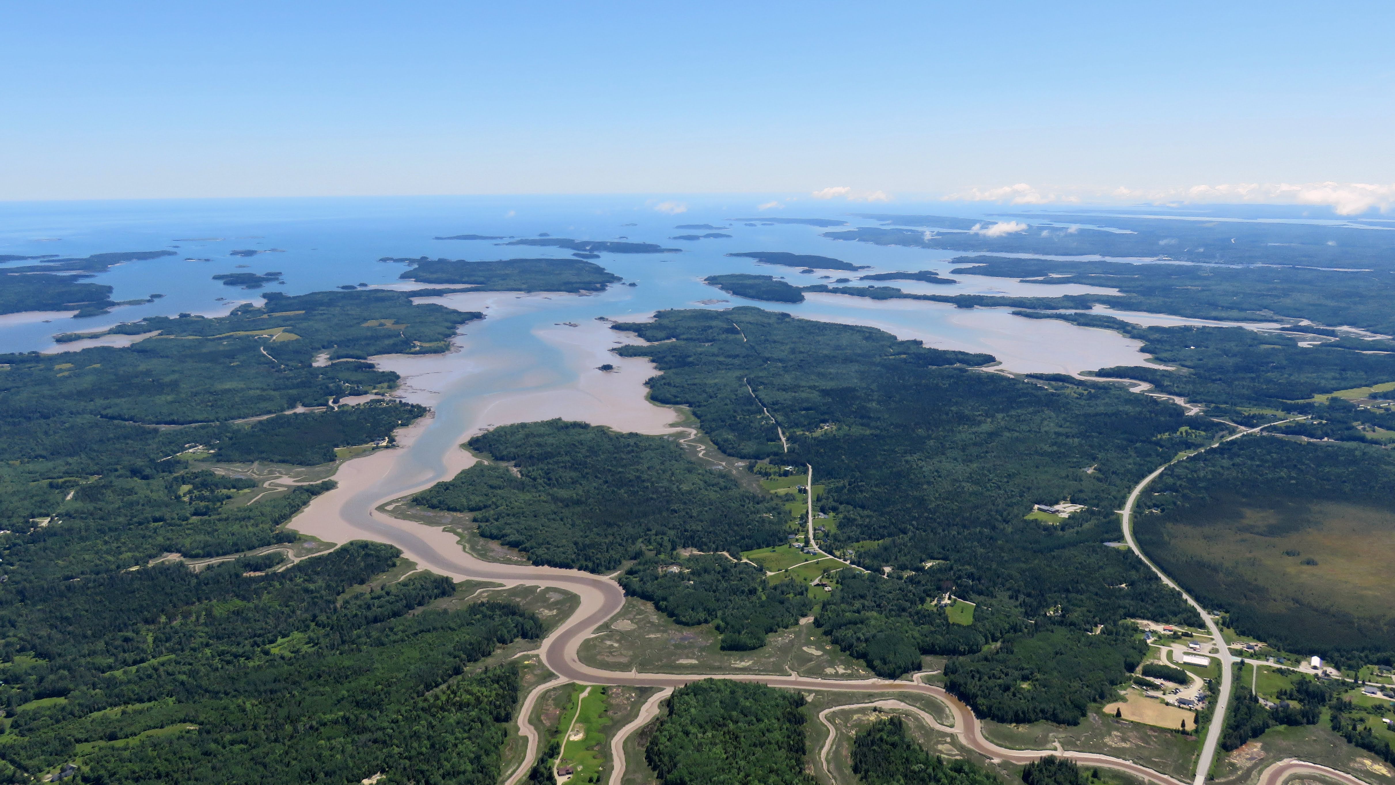
We passed directly over Rockland, ME. I was impressed by the length of the harbor pier, estimating it to be about a half mile long. Later in the week, I learned that my dimensional estimation skills need a lot of work. The Knox County Airport visible just outside of Rockland was my first destination in Maine.


I had hoped to capture some aerial photos of Boothbay Harbor, but the entire peninsula was obscured by a localized cloud layer.

 |
| Bath, ME. |
Passing Bath inbound for Brunswick, Portland Approach tried to help us dodge a radio-silent aircraft climbing away from Brunswick on a reciprocal course to ours. To avoid a collision, I dodged to the right, but so did they. So I dodged to the left and they did the same. It was like encountering someone face to face in a hallway and consistently choosing the wrong way to step around them. Shall we dance? Eventually, we evaded the other aircraft and set up to land on runway 19L.

From the downwind, we had a great view of Brunswick Landing, including FlightLevel Aviation, the piston aircraft parking ramp, Wild Oats (blue building, frame center), Flight Deck Brewing, and the P3 Orion on display in the little airpark.
Coda
 |
| Left base, runway 1L, Brunswick Executive Airport. |
I landed with a sense of accomplishment. Our excursion to Eastport meant that we had not only explored the easternmost airport in the United States, but that I had flown most of the Maine coastline from Sanford to Eastport. Combined with my time flying around New York City, the Chesapeake and Outer Banks, the South Carolina shore, the Georgia coastline, and the ocean side of Florida as well as the Keys, I realized that Warrior 481 has borne us along much of the Atlantic seaboard. These are places that we may have never visited without the ability of our wonderful time machine to bring them conveniently within reach.
I am so grateful for these experiences.
No comments:
Post a Comment