
Good Timing
| Date | Aircraft | Route of Flight | Time (hrs) | Total (hrs) |
| 13 Aug 2020 | N21481 | BHB (Bar Harbor, ME) - IWI (Wiscasset, ME) | 1.3 | 2136.9 |
"How was your stay?" asked the woman at Columbia Air Services.

"Great, but a little crowded for my taste." She chuckled ruefully in the way only a local would about tourists. Mackinac Island residents unflatteringly label their tourists as "Fudgies". I wondered how Maine locals refer to their seasonal visitors, then realized that maybe I did not actually want to know.

"Actually, we're down this summer because there are no cruise ships coming through. But you timed your trip well. We are busiest on the weekends, but it tapers off toward midweek. By Thursday, it starts to build back up again for the weekend. But I agree with you - come back in the off-season if you want to really enjoy what Acadia has to offer without crowds."

Columbia Air handled us very well. I was allowed to drive the Jeep directly to Warrior 481 (with an escort) to transfer our baggage to the airplane. Then the FBO took care of our Wretched Wrangler so that I did not need to deal with Enterprise further. And, yes, despite my best efforts, the car went back to Enterprise carrying slightly more gas than it had at delivery.

As I walked to where Warrior 481 was tied down, I took note of the SeaBee parked opposite our airplane. "What...is...that!?" The Bear had exclaimed in fascinated befuddlement when we first arrived. Remembering her interest in the ungainly looking amphibian, I called her over.
"Hey, Little Bear, want to get your picture with the SeaBee?"

It was probably her most enthusiastic participation in a photograph since we took the one of her and Izzy in their matching ice cream shirts.
Champlain's Barren Mountains
On the previous evening, Tom and I arranged to meet for lunch. He and Alicia would be in Wiscasset until the following Wednesday. The airport was a 40 minute flight from Bar Harbor and directly along my planned route home. It seemed like a smart way to break up the flight home and a great opportunity to visit with friends.
But when we launched from Bar Harbor, we did not immediately turn on course for Wiscasset. Instead, we did a low, counter-clockwise circumnavigation of Mount Desert Island to get some photographs. It was glorious. We thoroughly enjoyed locating the places we hiked from our aerial perch in the Warrior.
Despite the beauty beyond my cockpit windows, I also noticed that the Warrior's cylinder head temperatures (CHTs) were running higher then normal. Not to a worrisome extent and still cooler than where they ran during break-in, but certainly warmer than expected.

The Bar Harbor / Hancock County Airport is not actually on Mount Desert Island, but rather on the mainland quite close to the bridge to the island. The bridge was the first thing we saw as we climbed away from runway 22.


Lobster traps!

The area of ocean immediately west of Mount Desert Island is known as the Mount Desert Narrows. Moose Island is a small landmass that makes the narrows narrower. It appears to be connected to the big island by a slender, tide-dependent land bridge.

Multiple sheltered coves and harbors press inland around the rocky periphery of Mount Desert Island. From closest to farthest, the three pictured here are Goose Cove, Duck Cove, and Bass Harbor.

Continuing a counter-clockwise orbit, we got a closer look at Duck Cove.

Bass Harbor.


Next, I spotted Ship Harbor, which I hiked around during my first visit to the island in 2019.


The interesting topography of Bennet Cove and Long Ledge caught my eye from above.

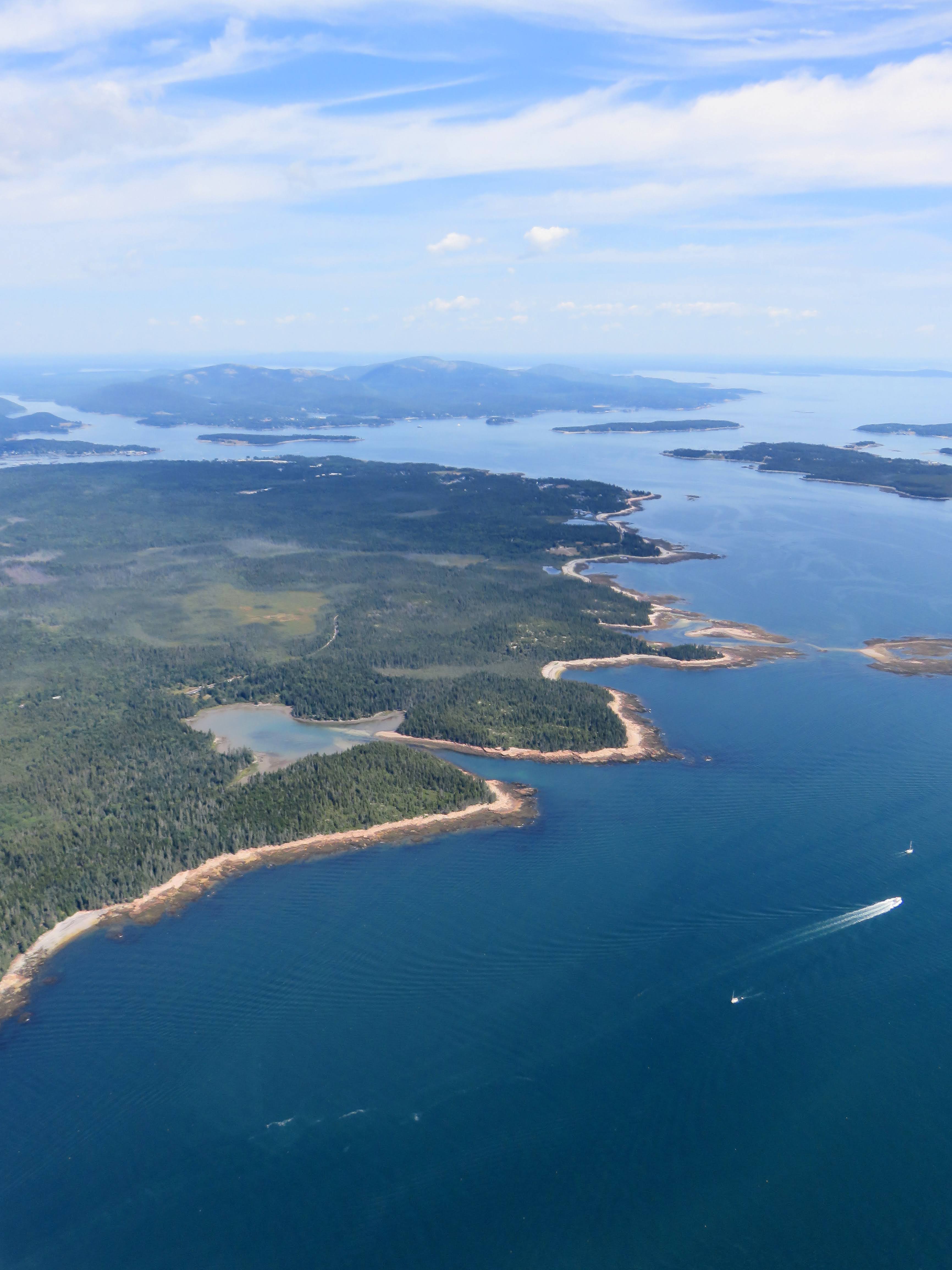
Sommes Sound nearly bisects Mount Desert Island. This massive bay also includes Southwest Harbor (frame center).

As we continued eastbound, the larger mountains on the island came more prominently into view, proudly displaying their barren tops as Samuel de Champlain first saw them.

Northeast harbor.

Bear Island! I cannot imagine why the existence of something called Bear Island would have so captured our attention, but it did.

I pulled the zoom back on the camera and captured what is probably my favorite photo of Mount Desert Island from this set. Sutton Island is immediately in the foreground.

Seal Harbor.

This is Jordan Pond, which seems like a misnomer given its size. (They don't grow ponds this big back home.) Immediately east (right) of Jordan Pond are the distinctly rounded North and South Bubble mountains with South Bubble in front of North. We hiked to the top of South Bubble that morning to see Bubble Rock.


Another familiar site from our travels: Otter Cove with the distinctive Otter Point projecting seaward.

Otter Point.

Remember my comments about the park being crowded? Note all the cars along Park Loop Rd.

Sand Beach was another popular destination that we steered clear of while in the park. Thunder Hole is located along this stretch of shoreline. Cadillac Mountain is the tallest feature at frame left.


Although there are many towns scattered across Mount Desert Island, there is no mistaking Bar Harbor for anything but Bar Harbor.


North of Bar Harbor, we turned on course for Wiscasset, crossing over the northern part of Mount Desert Island. From left to right, the two large bodies of water are Eagle Lake and Sommes Sound.
By flying around Mount Desert Island, we got to experience Acadia National Park from a different perspective while completely avoiding the crowds. There is something to be said for the gift of wings.
Lunch Date
We turned to a west heading to make our lunch meeting with Tom and Alicia. Though we departed Bar Harbor Airport earlier than planned, the flight around the island took longer than I expected because I guessed at the time required and failed to account for how freaking huge the island is. We were officially running late. Typical.

We flew along the coast, the ocean dotted with small, rocky islands in a way that is truly unique to Maine.


We flew past Rockland and Rockland Harbor. The Rockland Airport (Knox County Airport) marks the spot of my first landing in Maine and is home to the magnificent Owls Head Transportation Museum.

Closer to Wiscasset, we spotted a number of traps lurking in this waterway.
 |
| Wiscasset, ME |
I knew we were close when I spotted the large causeway that carries US-1 over the water near Wiscasset. We had driven that route several times in 2015 and remembered it well for the significant (lobster-related?) traffic back-ups in Wiscasset.
With the airport spotted, I maneuvered for a right downwind pattern entry for runway 25 and prepared to make our final vacation stop before returning home from our very 2020 vacation.
No comments:
Post a Comment