Where's Waldo Slatington?
"Cherokee Four Eight One, Allentown Approach, altimeter 30.48, remain at or above 3,500 feet."
My eyes moved between the sectional chart and the living map draped across the outside world as I descended toward Slatington, PA. Was the airport before or after that ridge? It is a common mental exercise required when descending toward an unfamiliar airport in Pennsylvania.
Leveling at 3,500, I finally spotted the airport through the Lehigh Gap, the runway tucked intimately along the west bank of the Lehigh River and behind the ridgeline. Allentown Approach thoughtfully held me high to clear the massive east-west ridge just north of my destination. I called the airport in sight.
Approach signed off with, "Cherokee Four Eight One, altitude your discretion, squawk VFR, frequency change approved."
Wrong Number
| Date | Aircraft | Route of Flight | Time (hrs) | Total (hrs) |
| 16 Dec 2023 | N21481 | SDC (Sodus, NY) - 69N (Slatington, PA) - SDC | 3.3 | 2764.7 |
 |
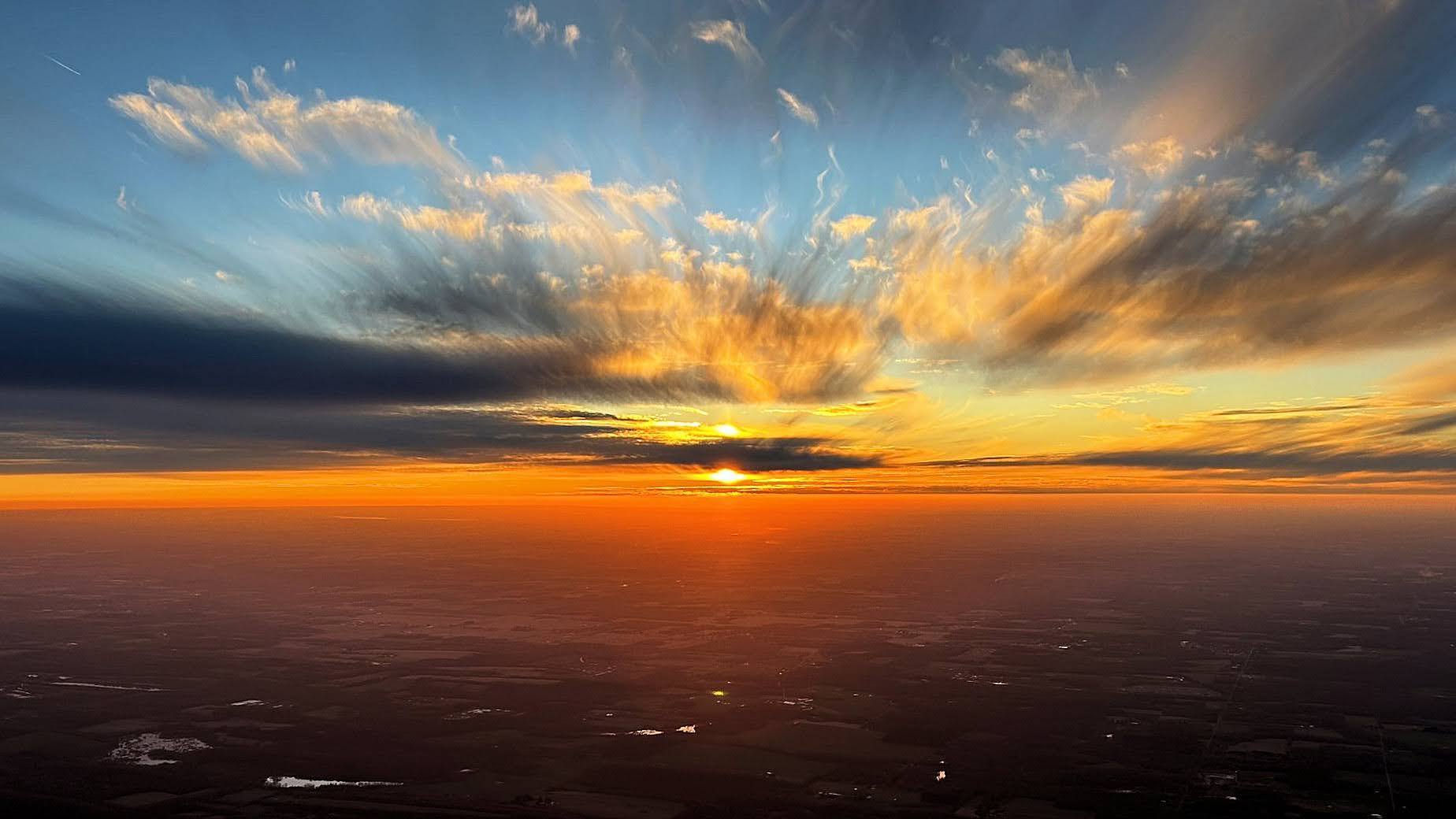
| A curious disturbance in an otherwise uniform cloud deck. |
"Aircraft on final at Frankfort Highland Airport, you are broadcasting on Syracuse Approach frequency 127.42. Please stop."
As I cruised serenely above an overcast dominating central New York, an increasingly exasperated approach controller at Syracuse tried in vain to reach a pilot broadcasting his pattern work at Frankfort Highland Airport on her frequency. Her multiple pleas for the pilot to desist were ignored entirely and I wondered if the offending pilot had his radio volume turned down in addition to being tuned to the wrong frequency. A multilayered example of cluelessness, the episode was not a shining moment for general aviation.
I was en route to Slatington Airport (69N), located 10 nautical miles northwest of Lehigh Valley International Airport in Allentown, PA. Recommended by my friend
Scott, the small family-run airport promised a grass roots vibe and nearby trails for hiking.
I aborted a previous attempt to land at Slatington in January due to to a combination of high wind and terrain that would have made a landing on the 2,455 foot long runway really unpleasant.
Over the Gap
A high ridgeline runs north of Slatington, broken immediately north of town to pass the Lehigh River through the so-called Lehigh Gap.
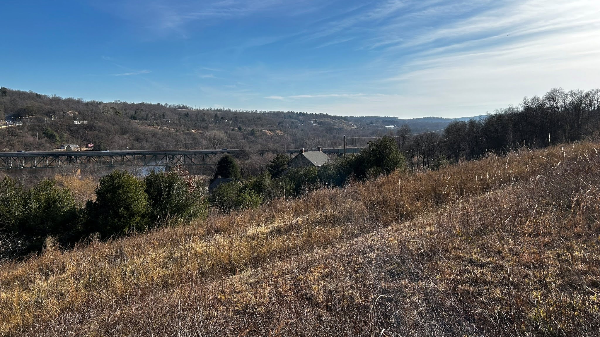
The Slatington Airport sits in a trough of low terrain along the west bank of the river. Even the adjacent town is at a higher elevation than the airport. Once I called the field in sight, Allentown cut me loose. I crossed the ridge and maneuvered west of the field to lose altitude and enter the pattern for runway 1.
As I lost altitude, I saw the southern portal for the Lehigh Tunnel that passes traffic on I-476 under the mountain. Having driven this highway a few times, I always find it hard not to imagine the incredible weight pressing down on the tunnel's ceiling.
 |
| Left base, runway 1, Slatington, with the Lehigh Gap visible to the north. |
While descending to pattern altitude, the town's elevation rose to meet me partway. I double checked to ensure that I was really flying the proper traffic pattern altitude. I was, but those houses looked closer than I would have preferred.
I smoothly rolled the wheels on to the runway in a satisfying, full-stall landing. Without a proper ramp available, I sought an appropriate place to park. The turf appeared to be flat and suitable for parking, but it was an uncharacteristically warm day for December and I worried about the grass being too soft. I parked on a small ramp near the fuel pump with the intention of rolling the Warrior back onto the grass if inspection revealed it to be firm enough.
Disembarking, I was met by one of the airport locals.
"Hi, I'm Chris," I said and extended my hand.
As we shook hands, he said, "I'm Roger Sell." My eyes flicked over his shoulder to the building behind him that was emblazoned with the very same name. Roger was the owner and operator of the airport. He concurred with my choice of parking spot and helped me push the Warrior back onto the grass to clear the area around the fuel pump.
Roger recommended investigating the Slatington Farmers Market if I was hungry, then wished me well and departed the airport.
 |
| A kit plane whose pilot I met in mid-2023 at the McVille ("MacVille") Airport. |
A Fly-In Farmers Market
 |
| D&L Trail with Slatington Airport hangars to the right. |
The D&L Trail, a rails-to-trails conversion that Scott is fond of riding runs along the western border of the airport. The Slatington Farmers Market is a short walk north along the trail from the airport entrance.
This former manufacturing facility for Keystone Lamp was repurposed as a farmers market in June of 2022. As I approached, I scented the smoky aromas of various foods being prepared and my stomach audibly rumbled. Based on the savory fragrance, I knew that I was in the right place.
Within Slatington's Farmers Market, stalls were available for people to sell various wares in addition to several quick casual eateries established in more permanent facilities. Options included True Blue Mediterranean Express, Takkii Ramen, the Pizza and Burger Hub, Uncle Jay's BBQ, and more. I enjoyed a tasty lamb gyro from True Blue. Although I somehow managed to avoid capturing people in the above photo, the Farmers Market appeared to be thriving.
The D&L Trail
Created from a former railbed of the Lehigh Valley Railroad, the D&L Trail runs from Wilkes-Barre to Bristol, PA with the Slatington portion set adjacent to the Lehigh River.
I followed the tail northbound toward the Lehigh Gap.
 |
| At the Lehigh Gap Nature Center. |
I spent some time on the Woodpecker Trail that ascends from the river valley up the high terrain defining the Gap.
In some places, the terrain is so littered with debris that the rocks themselves are blazed so that hikers can follow the course of the trail. (Note the rust-colored blaze on one of the stones.) I was grateful that I wore the right shoes for this kind of rugged terrain.
When I reached a sign warning of high bear activity in the woods, I decided that it was time to turn around.
Despite an undulating terrain, the D&L Trail betrays its railbed roots by remaining artificially flat. As if that were not enough indication, former vestiges of railroad infrastructure appear periodically along the trail's edge.
After a one hour walk of a few miles, I returned to the Slatington Airport.
 |
| Warrior 481 at Slatington. |
Testament
Scott once mentioned that the western edge of the airport property was lined by wrecked aircraft. I spotted them while landing that morning. Few pilots can resist this kind of sight and I went to investigate.
Partially hidden by a tree line, the corpses dozens of aircraft are slowly being reclaimed by nature.
I walked the tree line perplexed. Why are all these wrecks here?
Peeking into the cabin of this decaying V-tail Bonanza, I could not help but contemplate what these dead airplanes represented. At one time, each and every one of these rotting hulks was a gleaming physical manifestation of someone's dream.
Each mute wreck undoubtedly had many stories to tell. Stories of adventure and wonder, but ultimately, of an end.
I found myself contemplating the outcomes of each final flight and what ultimately happened to those who flew these airplanes. Some of the fuselages were remarkably intact and merely showed the ravages of nature. Others were horribly twisted and this lead to more sobering thoughts. I felt the hairs on the back of my neck rise as I encountered some of the worst examples.
Regardless of their purpose there, these dead airplanes had obviously been interred at Slatington Airport for many years.
 |
| Two Seven Uniform? |
I returned to my plane, pensive after walking the line of ruined airplanes while contemplating their stories. A local pilot landed and taxied in at the controls of a 1947 Champ. As he climbed out, I offered to help push it back into the hangar. The older pilot smiled broadly in thanks, but indicated that there was a winch to pull the plane back into the hangar and that he needed practice with it.
I asked him about the wrecked airplanes, which drew another big smile. "Those have been here a long time." He explained that Roger Sell's father once operated an aircraft parts business on the airport. He reflected on his days as an instructor when first time students would see the hulks along the tree line. They would often grapple silently with whether to comment on them aloud. Those who worked up the courage to do so would invariably ask, "Did all of those airplanes crash...here?"
"Not a one," he would tell them truthfully.
He also shared with me that the local EAA chapter had bicycles on site that could be borrowed by visiting pilots for rides on the D&L Trail. Stored in the brown shed pictured above, bicycles can be obtained by pilots cognizant of the CTAF.
We talked for a while and I absorbed some new stories before we shook hands and parted.
Serious Terrain
 |
| Taxiing past the the parted-out airplanes at Slatington. |
I lined up on runway 1 with the Lehigh Gap directly ahead and accelerated down the runway. The ridgeline begins about 1 mile beyond the departure end of the runway, a distance that is closed quickly. As I climbed, I was surprised by the high elevation of the terrain along each side of my departure path. The Slatington Airport is truly in a deep trough. With the Garmin GNS-430W flashing "Terrain Advisory" at me, I continued to climb straight ahead toward the ridgeline to gain sufficient altitude for a turn. Fortunately, the wind was calm; a strong northerly wind flowing over the ridge could conceivably create a dangerous downdraft for departing aircraft. This observation reinforced the wisdom of avoiding Slatington on that previous windy day in early 2023.
Although I planned a left turn-out, a right turn put me over lower terrain sooner and I chose to fly in that direction. Eventually, I put more air between myself and the terrain, but it did not happen as rapidly as I would have preferred. I should have flown a higher performance take-off than I did and will be primed to do so next time.
 |
| The Lehigh Gap. |
I circled east of the field and beneath the outer shelf of Allentown's Class Charlie airspace to gain sufficient altitude to cross the ridgeline.
 |
| An aerial view of Slatington Airport showing the terrain rise to the west of the airport. |
I absolutely love airports like Slatington; unique, family-owned, a little tricky to manage, and filled with friendly grass-roots pilots. I will definitely be back.
 |
| Flying over the Lehigh Gap. |
 |
| Northbound along Seneca Lake en route to the Williamson Sodus Airport. |