Inspiration: Hallowed Ground
 |
| Photo of Orville Wright launching in the Flyer at 10:35 am on December 17, 1903 by John T. Daniels. |
"In commemoration of the conquest of the air by the brothers Wilbur and Orville Wright
conceived by genius achieved by dauntless resolution and unconquerable faith."
High atop a massive dune in Kill Devil Hills, NC stands a 60-foot tall granite pylon erected in tribute to the Brothers Wright of Dayton, OH who are widely recognized as the first to truly master heavier than air flight on December 17, 1903. While there is still debate over who did what first, the Wright Brothers ushered the field of aeronautics through a quantum leap and Kill Devil Hills, where their experiments occurred, is viewed by many aviators as hallowed ground.
Stretch Goal
When the 2023 Williamson Flying Club Activities Committee set about planning events for this year, we committed to a stretch goal of making a club trip to First Flight Airport (KFFA) in Kill Devil Hills, NC. Established immediately adjacent to where the Wrights performed their successful flights on 17 December 1903, the modern airport is an aviator's mecca, an opportunity to navigate the same ocean breezes that facilitated the Wright's experiments and to touch down on hallowed ground. It would be the longest distance club fly-out undertaken by the committee since its inception in 2013. Though we have struggled over the years to get club members to venture beyond the local area, First Flight is a bucket list item for many aviators. It would be my first return in a decade.
With a pilgrimage to First Flight as the primary goal, secondary objectives included a lunch stop on Tangier Island in the Chesapeake Bay and exploration of other airports scattered throughout the Outer Banks.
Day 1: Morning Preparations
| Date | Aircraft | Route of Flight | Time (hrs) | Total (hrs) |
| 30 Jul 2023 | N21481 | SDC (Sodus, NY) - TGI (Tangier, VA) - CPK (Norfolk, VA) | 3.7 | 2681.9 |
The Williamson Sodus Airport hummed that morning as seven intrepid participants gathered to begin the trip. Two private aircraft and two club planes were meticulously pre-flighted, rolled from their hangars, and fueled under a beautiful blue sky. Though the date was chosen months in advance, weather forecasts suggested ideal VFR weather for the duration of the adventure.
 |
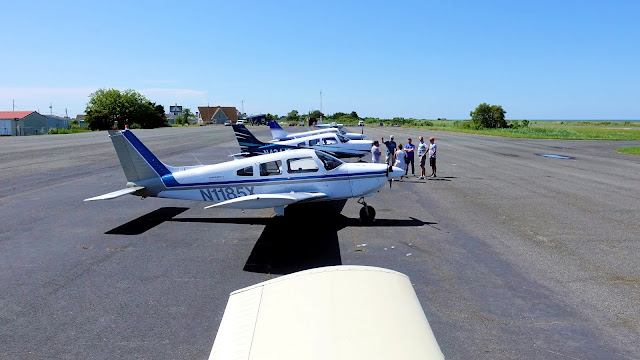
| Warrior 481 and Eight Five X-Ray parked at the SDC fuel farm. |
 |
| Scott and Kim walk to Eight Five X-Ray as Warrior 481 waited for her crew. |
We gathered to discuss last minute details before the four crews boarded their separate aircraft. We were wheels up around 8:00 am. With Tom in the right seat of Warrior 481, we climbed to 8,000 feet and set course for the Chesapeake Bay.
 |
| Keuka Lake passed below as we left the local area. |
The Mystique of Tangier Island
 |
| Sectional chart depicting the position of Tangier Island. |
Tangier Island is often cited as a bucket list destination for aviators. Technically belonging to the state of Virginia, the island's location in the middle of the Chesapeake Bay is quite remote. It is surrounded by areas of restricted airspace and miles of brackish water. Cloistered so far from the mainland, the population of roughly 400+ shares a unique dialect and an economy focused on crabbing. Tangier lays claim to a title of "soft shell crab capital of the world". In addition to the island's profound isolation, it has lost more than half of its landmass since the mid-1800s and rising seas threaten the town's future. For itinerant aviators, the runway on Tangier Island is a gateway to a unique and remote seafaring community whose existence is imperiled by the very water that defines and sustains it.
Across the Chesapeake
 |
| Approaching the Chesapeake Bay. |
I cleverly planned an IFR flight with routing that minimized time over open water. Potomac Approach first assigned a revised routing north of Baltimore, then undid both the amendment and my original plan by clearing me direct to Tangier from approximately due north of the island. Cleverness be damned.
 |
| Martin State Airport with Baltimore, MD in the distance. |
Passing Baltimore placed us within a 60 nautical mile radius of the Washington VOR (DCA), thus requiring our cohort of pilots to be trained on the FAA's procedures for the Washington DC Special Flight Rules Area. I have taken this course three times over the years, but refreshed on it anyway for the trip.
We went feet wet over the Chesapeake around 10:00 am and marveled at the complexity of waterways feeding fresh water into the massive bay. The mighty Susquehanna and Delaware Rivers meet their ends here. The bay's surface is dotted with marshy islands forming a chain terminating with Tangier Island.
 |
| On approach to Tangier Island. |
I arrived very aware that the island was small and remote. I was still stunned by how tiny Tangier Island seemed in the vast Chesapeake. The relatively short 2426 foot long runway appeared massive versus the size of the island, though the stated runway length does not include the southern third of former runway no longer available for use. With a strong 20+ knot wind out of the north, we set up for landing on runway 2 by flying a right-handed pattern designed to keep traffic out of the restricted area immediately west of the island. Tom and I were the first of the group to arrive on Tangier.
On downwind, we passed Port Isobel located just east of Tangier. Although it was once inhabited, the residents abandoned their homes in the 1920s due to rising seas. The island is now operated by the Chesapeake Bay Foundation and used for environmental education programs.
 |
| Final, Tangier Island, runway 2. Photo by Tom. |
Once lined up on final, a difference in color for the southern third of the runway made it obvious where the usable runway started. (Well, that and the large "2" faintly painted at the threshold of the actual runway.) With such a stiff headwind, the landing roll was short and we taxied to the north end of the runway for parking. The usable runway was in good condition. The other part, while potentially a good option in an emergency, was dominated by vegetation growing through cracked pavement.
Vignettes from Tangier Island
 |
| Me. Photo by Tom. |
The moment my wheels touched down on Tangier's runway, I added a 262nd airport to my ever-growing list.
In case there was any doubt of our location.
 |
| Scott and Kim on Tangier Island with Eight Five X-Ray. Photo courtesy of Scott. |
Ed landed shortly thereafter in his Archer, followed by Gilead, Scott, and Kim in Eight Five X-Ray, then Dan in One Delta Tango.
 |
| Panoramic of WFC aircraft at the Tangier Island Airport. |
Everything we saw on Tangier bore testimony to a hardscrabble life. Nothing was cushy or fancy there. A local is quoted on the official website as saying, "It is not an easy way of life. In fact, it is a true labor of love. Commercial fishing and crabbing for the Chesapeake Bay Blue Crab is physical and demanding, but it is the love for the Chesapeake Bay, its wildlife, and its beauty that makes it worth all the aches and pains we live with each day." Even the signage seemed to be having a difficult time of it.
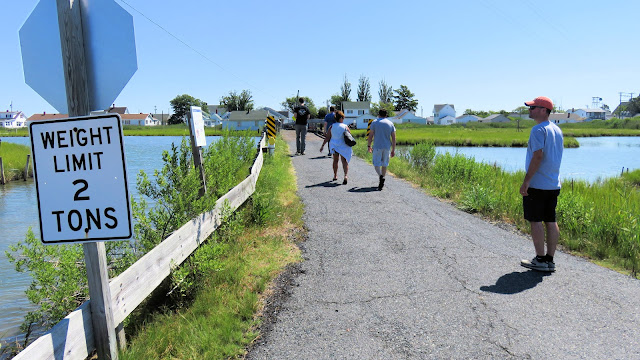
Automobiles are rare on Tangier. Most residents get around by golf cart or bicycle. The width of the roads reflects this. After careful contemplation, Tom decided that we were probably within the stated weight limitations of Long Bridge for crossing.
Have a boat, leave a boat. Need a boat? Take a boat.
This vessel seemed like an excellent opportunity to get in on the ground floor of a new enterprise.
The island's water tower stands beside the K-12 Tangier Combined School.
 |
| Overlooking the "Big Gut" from Long Bridge. |
Lorraine's is probably the best known lunch destination on the island, but was closed when we arrived.
Seafood restaurant Fisherman's Corner did not survive the pandemic.
We found lunch at Four Brothers Crab House and Ice Cream Deck. I had the crab cake sandwich and it was good.
 |
| Ed, Gilead, Dan, Scott, and Kim at Four Brothers. |
For a bunch of famished pilots, everyone looked remarkably chipper in this partial group photo taken while waiting for lunch.
After lunch, we paid $5 each to take a narrated tour of the island. Despite all that I read about Tangier's unique American English dialect, I don't know that I could have distinguished the speech of Tangier residents from mainland Virginians. Then again, I am a chemist, not a linguist.
 |
| Tangier, VA. |
Tangier's skyline is dominated by the Swain Memorial Methodist Church, established in 1835 (above, far left).
Fresh water is supplied by five artesian wells reaching 1000 feet deep into the Earth in search of aquifers free of salt.
We paced our strides carefully on Main Ridge Road to avoid entanglements with local law enforcement.
Telecommunications to the island are provided by microwave dishes installed on a tower on the east side of Tangier.
The above sentiment can be particularly true during the winter when ferries and aircraft are unable to reach the island.
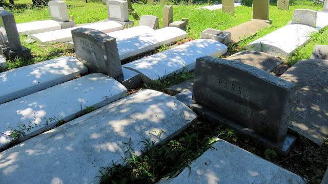
Due to space constraints, cemeteries are located directly adjacent to people's homes.
Tangier's cash crop lurks beneath the water.
An Ercoupe parked at the Tangier Island Airport.
 |
Group photo at the Tangier Island Airport: Dan, Gilead, me, Kim, Scott, Tom, and Ed. |
To File or Not To File?
Cell service was essentially nonexistent on the island. It improved to marginal at the airport, with just enough data trickling through to reveal low clouds and rain over First Flight. We devised a new plan: hop to Chesapeake Regional Airport (CPK, south of Norfolk) for fuel and to wait out the weather at Kill Devil Hills. Tom joined Ed for this leg so that every airplane had an instrument rated pilot on board just in case filing became necessary to manage the ceiling around Norfolk. If needed, we would pick up IFR clearances in the air; bandwidth was insufficient to file from the ground.
Departing Tangier, I was once again struck by its diminutive size and isolation. I turned due east toward the nearest mainland and climbed away from the vast basin of saline surrounding the island.
The automated weather broadcast from Chesapeake Regional suggested a low VFR ceiling. I wanted to be at a higher altitude given all the water I would cross flying over the mouth of the Chesapeake between Cape Charles and Norfolk. Gilead and I successfully requested pop-up IFR clearances with Norfolk at 6,000 feet while Dan and Ed proceeded VFR at lower altitudes.
 |
| Southbound over Cape Charles. |
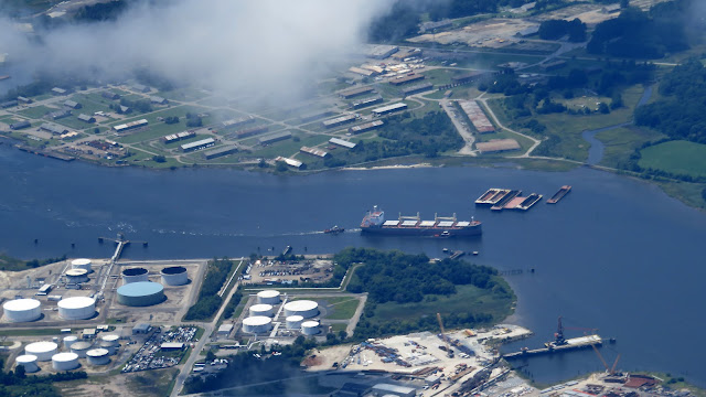
US-13 crosses the mouth of Chesapeake Bay as a series of trestle bridges with tunnels that go beneath the shipping lanes. At first glance, the highway segments above water appear to be bridges to nowhere.
 |
| Norfolk Naval Station, Chambers Field. |
Over Norfolk, conditions were less cloudy than the automated weather at Chesapeake Regional suggested. Dan and Ed proceeded inbound VFR without any problems. Gilead managed a practice instrument approach with Scott as safety pilot. I simply cancelled IFR and joined the surprisingly busy pattern.
Fuel Stop and Weather Check
After landing at Chesapeake Regional (airport #263), everyone took the opportunity to refuel in anticipation of exploring the Outer Banks the next day. Review of current weather conditions indicated that the rain and low clouds had moved off over the Atlantic Ocean from our destination, making our weather delay exceptionally brief.
Fuel, pause, sump, depart. After a quick turn, we launched our four airplanes skyward and flew in trail to our most anticipated destination: First Flight Airport in Kill Devil Hills, NC!


No comments:
Post a Comment