Reservations about Reservations
"Hangars Cafe, how can I help you?"
"Do you take reservations?"
"It depends. How many people are in your party?"
"Ten."
"Oh, you will definitely need reservations!" She promptly created a lunch reservation for my party of ten at noon on July 21, 2024.
To put it mildly, I had reservations about making reservations. July 21 was to be a seventh attempt at a club fly-out to the Manhattan skyline. Over the previous twelve months, I cancelled that trip six consecutive times. The last thing that I wanted to do was waste anyone's time and my confidence in a successful outcome for this excursion was shaken by the cancellation streak.
Flying the Skyline
 |
| South of Manhattan in 2019. |
In 2019, the Williamson Flying Club Activities Committee organized a Manhattan skyline flight as a club event. It was a huge success and a popular enough request in subsequent years that planning a trip down the Hudson River became an annual occurrence. Normally, we fly the charted Skyline Route that puts aircraft in the lowest elevations of the New York Bravo airspace (rather than the uncontrolled Hudson River Exclusion below). We fly south down the Hudson River along the west side of Manhattan, turn 180° after passing the Statue of Liberty, and request the East River northbound with a transition back to the Hudson River northbound over Central Park. Transient fixed wing pilots cannot fly the East River Exclusion at all, so this course must be flown in the airspace with explicit ATC consent. While being able to fly the East River and truly circumnavigate the island of Manhattan is the main advantage of the Skyline Route procedure, the reduced chaos of being under positive control is another. Not only is it a spectacular flight to make, but I think there is instructional value in having our pilots fly in Bravo airspace while interacting with New York area ATC.
 |
| Example ForeFlight ground track of my route around Manhattan in 2020. |
This grand sightseeing adventure never happened in 2023 due to a combination of terrible weather and lousy visibility from Canadian wildfires. I scheduled and canceled this flight five times in 2023, which was exhausting for me and exhausting for everyone who signed up to join. Unclear on whether wildfire smoke would be a problem in 2024, I scheduled the flight to NYC early in the season in hopes of getting it done before wildfires really got going. Unfortunately, June 9 was a total washout and we logged our sixth consecutive cancellation in the span of a year.
The Intrepid Bravo Busters
We had three aircraft slated to go that morning.
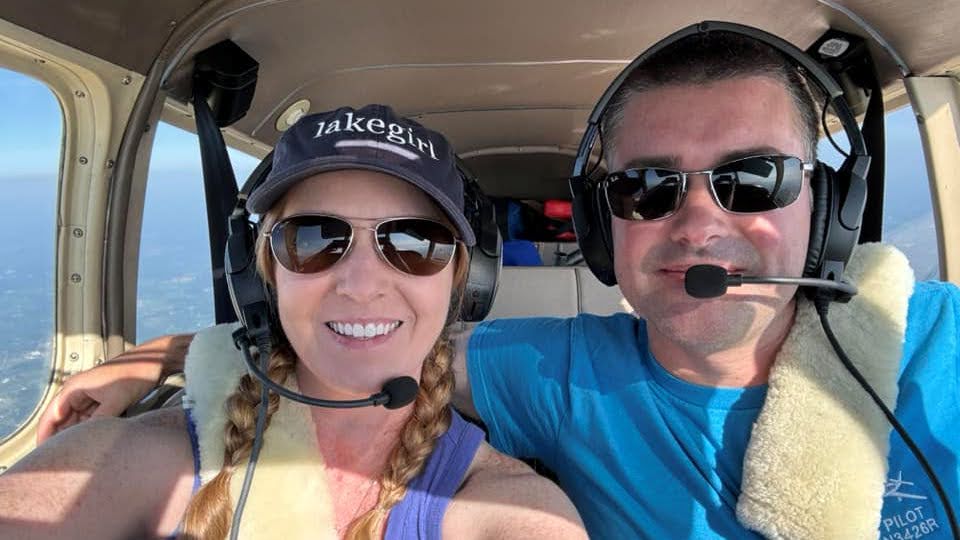
In my airplane, I was accompanied by Alyssa and Mark. Alyssa is a recently-soloed student pilot who has not only been plowing through her training, but taking great advantage of this year's Activities Committee excursions including our recent trips to Washington DC and Block Island. My friend Mark is not a pilot, but has accompanied me on multiple flights, starting with a trip from Hilton Head, SC to Tuskegee, AL and most recently on an aerial city tour of Boston. NYC would provide an interesting contrast from the experience over Boston.
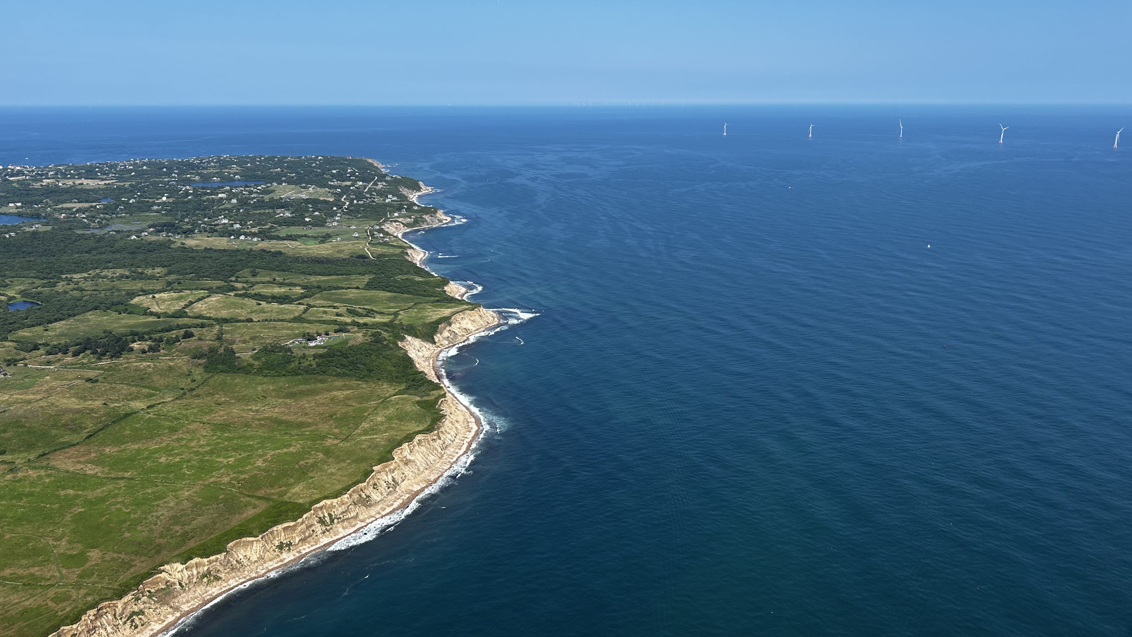
Also departing Sodus that morning were Scott and Kim in Cherokee Eight One Six. Scott flew this route with me as a right seater in 2019 and again with Barry in his Seneca in 2020, but all attempts to pilot himself around Manhattan were scuttled by bad weather or, in one memorable case, a failed club plane alternator. Manhattan was his white whale and it was finally going to happen for him on July 21. I think he was anxious about the air traffic control communications, but he planned to follow me in trail so that he could see how the radio work went.
Club member Barry owns a beautiful 1946 vintage Grumman Widgeon amphibian that he bases at Greater Rochester International. He launched that morning with a friend (Wellington) and a cohort of WFC post-solo student pilots: Dan, Eric, and Jerry. For Barry, who has flown this route many times in a Piper Seneca, flying the Widgeon at skyscraper height around Manhattan was a bucket list item.
Yellow Peril
| Date | Aircraft | Route of Flight | Time (hrs) | Total (hrs) |
| 21 Jul 2024 | N21481 | SDC (Sodus, NY) - MGJ (Montgomery, NY) - 44N (Lagrangeville, NY) - SDC | 5.3 | 2866.2 |
Our first stop of the morning was the Orange County Airport (KMGJ). It served as a fuel and/or restroom stop for anyone who needed it prior to flying the skyline. It was also a convenient location north of the Skyline Route where we could pick up flight following with New York Approach, thus streamlining entry into the procedure. However, a lot of flight training occurs at Orange County and I have seen some questionable airmanship from some of the novices orbiting the field in the past.
The New York Approach controller responsible for radar services to Orange County did not really want to talk to any of us that morning and seemed pleased to drop us once we were close enough to our destination. I worried that it did not bode well for our next leg to the Skyline Route.
While we were approaching the Orange County Airport, a student launched in a Cessna from runway 22. I turned due south well outside the pattern as a delay vector to allow the student to fly a normal pattern with intentions of following him to a landing. Instead, the student flew a grossly extended departure leg, then turned directly toward us, and ultimately passed beneath on a west heading.
"What do you think he's doing?" I asked Alyssa.
"I have no idea!" she exclaimed as we watched him scoot underneath.
I concluded with a shrug that the student was departing the area to the west and proceeded to enter the traffic pattern while making the appropriate advisory radio calls.
We were established on a right downwind for runway 22 when the student made his next radio call indicating that he was also on a right downwind for the same runway. I could see him flying parallel to our course at least 2-3 miles off my left wingtip.
WTF?! He was too far away from the airport to be considered in the pattern and I confess that my impatience got the better of me. "You're on downwind all the way out there?" I queried.
"Well, you were flying in so..." His answer did not make a lot of sense and I was annoyed that he chose to blame me for the non-standard pattern he was flying because I intentionally gave him space to fly a normal pattern. I chalked it up to inexperience. Maybe he was a recent solo student and did not know how to handle another aircraft joining the pattern. On reflection, I should have explicitly told him that I was letting him go first, though in the moment, it seemed obvious and unnecessary.
In the WWII days, Naval primary training airplanes were painted yellow and called “yellow peril” due to the unpredictable things students pilots sometimes do. Peril, indeed.
Flagship
Barry was already on the ground when we arrived, having landed early to refuel the thirsty Widgeon.
 |
| Photo by an anonymous fellow aviator at Orange Country Airport. |
We assembled the entire group and persuaded another recent arrival to take our picture with the Widgeon, the unofficial WFC flagship for the day. From left to right are Wellington, Alyssa, Jerry, Eric, Dan, Mark, me, Kim, Scott, and Barry.
 |
| Warriors Four Eight One and Eight One Six parked side by side at Orange County. |
During the pit stop, Scott, Barry and I discussed next steps for flying the Skyline Route. None of us were confident that the New York Approach controller from our inbound flight to Orange County would be particularly helpful in arranging flight following or a Bravo clearance. However, I proposed that we try anyway and, if the controller shunned us, we could revert to the previous practice of contacting LaGuardia Tower at the Alpine Tower, the visual landmark that marks the beginning of the Skyline Route.
 |
| Barry about to take runway 22 for departure from Orange County in the Widgeon. |
Barry departed first and turned eastbound off the departure end of runway 22. To my surprise, we did not hear him on the radio again until we were over the East River. We departed on a more southeast heading to ensure clearance with Stewart International's class Delta airspace. Scott followed in Eight One Six.
"November Two One Four Eight One, what can I do for you?" answered New York Approach brightly. A shift change! Our new controller was only too happy to put us in for flight following to the Skyline Route. Near the banks of the Hudson River, he pushed us to a different New York Approach sector and that controller cleared us into the Bravo. Scott followed our lead and soon possessed both a squawk code and a Bravo clearance himself.
 |
| Alyssa, Mark, and me about to fly the Skyline Route. |
We had a brief moment of low workload before arriving over the Hudson River and turning southbound for NYC.
Skyline
To my mind, each adventure in the sky over New York City begins with the Tappan Zee Bridge. Known to New Yorkers as the Governor Mario M. Cuomo Bridge, FAA materials still call it the Tappan Zee and, as a result, so do I.


 |
| ForeFlight screen shot taken five miles north of the Alpine Tower. |
My traffic display showed our three aircraft at 1,500 feet flying southbound along the west bank of the Hudson River with me in the lead and Scott bringing up the rear.

The Alpine Tower is a rare physical manifestation marking the boundary of Bravo airspace. It cannot be missed by pilots tracking southbound. I explained to Alyssa and Mark that, once abeam the tower, New York Approach would pass us to a dedicated frequency at LaGuardia Tower that would manage us in the Skyline Route until we reached Midtown Manhattan where Newark Tower would take over.
Sure enough, the frequency change was issued as soon as we reached the tower. We were at 1,500 feet when we reached the tower and LaGuardia had us climb to 2,000 feet at the start of the Skyline Route. Past experience indicates that ATC would want us back down at 1,500 feet once we requested the East River.

As is typical at this time of day, the view toward the sun is hazier than desired, but haze does little to take away from the impressive view of Lower Manhattan. Mark and I were in agreement that while Boston was really cool, New York City is much more vast in scope.
Now on with Newark Tower, I made the East River request. This was granted and we were issued a descent to 1,500 feet as expected.

Although we did not circle the Statue of Liberty, we had a beautiful view of her from across New York Harbor once tracking north to the East River.

I love this angle on Lower Manhattan. I have taken a photo at this same position (or as close to it as I can get) every year we have flown the skyline and I never tire of it. Whenever I look upon this part of the city, a tiny voice in the back of my mind asks, "How is that island not sinking under all of that weight?" It looks...impossible.
 |
| Me taking a photo of Lower Manhattan. Photo by Alyssa. |
What's the secret to good aerial photos? The sun at your back, a camera with decent optics, and an open window. Add to that, in a low wing airplane like the Warrior, shooting at a forward quartering angle to keep airplane bits out of the picture. With one photo, Alyssa had outed all of my tricks!
 |
| Barry at the helm of the Widgeon. Photo by Eric. |
As we started up the East River, we were switched back to LaGuardia tower. Moments later, we heard Barry on frequency requesting a Bravo clearance to fly the East River. I suspect that Barry was so discouraged by New York Approach that morning that he decided to fly the uncontrolled Exclusion rather than attempt New York Approach again. But if he wanted to tour the east side of Manhattan, he needed the clearance now. LaGuardia cleared him in and Barry climbed out of the Exclusion to 1,500 feet. It was a different path than the one Scott and I took, but it all worked out.

In the morning, the lighting on Manhattan is far more favorable from the East River than the Hudson.

We flew directly over the distinctive and famous Brooklyn Bridge, first opened in 1883.

Moments later, we cleared the Manhattan Bridge. Significantly newer than the Brooklyn Bridge, it was opened in 1909. The fancy, shiny structure on the west end of the Manhattan Bridge is One Manhattan Square, a luxury residential tower completed in 2019. By replacing a neighborhood grocery, the ripple effect of building this skyscraper is that food became more costly at the remaining local markets.

Continuing north, we passed the Williamsburg Bridge connecting the Lower East Side of Manhattan to the Williamsburg neighborhood of Brooklyn. Completed in 1903, it supplanted the Brooklyn Bridge as the longest suspension bridge in the world until it was itself replaced on that list in 1924.

It is easy to discount the "lesser" buildings between Lower Manhattan and Midtown as being of insignificant height, but many of these buildings are tall enough that they would be impressive in a place like Rochester. It just goes to show how truly monstrous the biggest towers actually are.

A rogue cloud cast a shadow on the distinctive buildings in Midtown including the Empire State and the newer steel and glass towers of Hudson Yards on the west side. The golden octagonal pyramid atop the distinctive New York Life building nonetheless shines brightly.

I always admired the Art Deco lines of the 1930 Chrysler Building, but it is surrounded by other taller structures and difficult to locate. This time, I found it among the clutter! Although it was the tallest building in the world when it was built (for not quite a year when it was surpassed by the Empire State Building), it is now only the 12th tallest in New York City.

Completed in 1952, the headquarters of the United Nations stands on the East River in the Turtle Bay neighborhood. Sadly, we were on the wrong side of the building to see all the flags.

The Midtown towers immediately south of Central Park seem to include multiple particularly slender designs.

We reached Roosevelt Island (out of frame) and the 1909 Ed Koch Queensborough bridge that passes over the island and connects the Upper East Side of Manhattan with the borough of Queens.


On days with a westerly wind, crossing over this portion of the city east of Central Park often results in an abrupt updraft where wind is deflected skyward by the line of buildings along the park's edge. They act exactly like a ridgeline and, as a case in point, there was enough wind that day to give us a bump as we overflew the park.


If Manhattan Island were a petri dish and New York's skyscrapers bacteria, Central Park would correspond to a portion of the dish smeared with antibiotic. It is striking to see such a vast (843 acre) forested area so crisply defined within a city.

Merging back into northbound traffic over the Hudson River, we spotted Yankee Stadium. The stadium put us on a clock to be out of the area by 12:30 before a temporary flight restriction (TFR) went into effect for the Yankees vs Rays game that afternoon. When I first pursued a pilot certificate, I never imagined that researching major league baseball schedules would be a component of flight planning. Then again, when I started training, these so-called "stadium TFRs" did not exist.

Passage north over the Tappan Zee marked the end of our New York City adventure. By pure coincidence, Mark learned that Dena and Izzy were on the bridge as we passed over, but were driving westbound where they probably could not see us cross over the east end of the bridge.
Through Complex Airspace
I think it is difficult for non-pilots to visualize (or make sense of) the complex superposition of airspace overlying the New York City area.
 |
| ForeFlight GPS ground track overlaid on the New York Terminal Area Chart. |
The light blue track shows our course through the New York Bravo airspace complex. We passed relatively close to busy airports like Teterboro, Newark, John F. Kennedy, and LaGuardia.
 |
| ForeFlight GPS ground track overlaid on an aerial map of the New York City area. |
Above is the same ground track overlaid on an aerial photo and map of the New York City area.
Lunch and a Show
We were late for our noon reservation by several minutes. As the first aircraft to land at Sky Acres, I brought the Warrior to a stop on the ramp and sent Alyssa inside to inform Hangars Cafe that we had not reneged on our reservation.
While Alyssa attended to the restaurant, Mark and I pushed the Warrior back into a parking space at the unique general aviation airport occupying a terraced hillside.

I waited on one of the ramps for Barry's arrival. Watching the stalwart amphibian on final approach, I was reminded of how solid the aircraft felt in the air when I got to fly her.


On clearing the runway, Barry was faced with a heavy airplane and an upsloping taxiway. Even in Warrior 481, I need about 1500 rpm just to climb the hill, over 50% more power than I would generally need for taxi. In the heavy Widgeon, it sounded like Barry was closer to take-off power. Announced with such sound and fury, arrival of the Widgeon on the ramp captured the attention of every patron at Hangars Cafe.
We might have been late for our reservation, but at least we compensated with a show!
 |
| Mark, Jerry, Wellington, Dan, Barry, me, Kim (hiding), Scott, Eric, and Alyssa. Photo by Alyssa. |
The restaurant gave our table away moments before Alyssa got to them, but they flexed things around and accommodated us right away. The food and service were as excellent as anticipated!

After lunch, we fueled all three airplanes for the flight back to Sodus / Rochester. Here, Barry demonstrated that he is truly king of the mountain.

We pulled the Warriors up to the pump while Eric and Dan served as line crew for Eight One Six.
 |
| Warrior 481 and Warrior 816 ("Williamson One"). |
Snotty
Three airplanes set off from Sky Acres for home. Each used very different strategies to manage the clouds encountered en route.
Barry launched first and essentially stayed below the clouds all the way home. Scott was next and attempted to outclimb the build ups, but they topped out higher than his engine could carry him. After a long initial climb that helped him clear the Catskill Mountains northwest of Sky Acres, he descended back below the bases.
I also tried to climb above the clouds, but seeing that it was futile I cheated and played the pop-up IFR card with Boston Center. Trapped in a veritable box canyon of clouds, Boston Center came through with the clearance just in time and we cruised home through the clouds at 8,000 feet.
 |
| Snotty weather over the Catskills. |
I had a panic moment later in the flight when ATC was unable to contact Barry. I checked ForeFlight and, although I was receiving ADS-B traffic data, the Widgeon was nowhere to be seen. I worried that something had happened to them. Fortunately, Alyssa had adequate cellular service that she was able to track the Widgeon and verify that they were still in the air. Whew...
Of course, it was also due to adequate cell signal that Mark learned Biden had dropped out of the presidential race as we were somewhere over central New York State.
After six cancellations of the New York flight, we were due for a win. And it was a win! I planned an event that actually went forward, Scott triumphed over his white whale and flew the skyline while acquitting himself well on the radio, and Barry checked off a bucket list item of flying his Widgeon to New York City while sharing the experience with multiple student pilots in the process. Another great day in the logbook!