
| Date | Aircraft | Route of Flight | Time (hrs) | Total (hrs) |
| 27 Feb 2015 | N21481 | SDC (Sodus, NY) - LCI (Laconia, NH) - B18 (Alton Bay, NH) - SDC | 5.6 | 1381.6 |
A Unique Attraction
Finished with my lunch at Shibley's at the Pier in Alton Bay, I stood and absorbed the view outside the window, contemplating my airplane parked below on the frozen surface of Lake Winnipesaukee.

"How was it landing on ice?" inquired a neighboring diner.
"I've landed on ice many times over the years," I answered. "But it always had pavement under it before," I added with a smile.
 |
| Sectional depicting Alton Bay (B18) |
Alton Bay's Ice Runway is unique in that it is the only FAA-approved ice runway in the continental United States. The "field" is charted as a seaplane base, though it is evidently much less active in that capacity than it once was. However, when the winter ice on Alton Bay thickens sufficiently (12" is the minimum), it becomes an active airport and a popular destination for pilots seeking a unique experience in the Northeast.
Pilots owe this experience to the facility's volunteer manager of the last seven years, Paul LaRochelle. Airport status is updated in the NOTAM system and pilots can call (603) 875-3498 for a detailed recorded status update (consider it Alton Bay's version of ATIS). By its very nature, the airport lives a transient existence. It typically opens in January and the government mandates that runway operations cease by March 15.
Alton Bay has been on my bucket list since I first learned about it. I am already very familiar with the area, having landed at nearby Laconia Municipal (LCI) and Plymouth Municipal (1P1), the latter being a turf field nestled among the foothills of the White Mountains. Unfortunately, a lot of weather can occur between western New York and central New Hampshire in the winter; weather that thwarted all prior plans.
Unforecast

I arrived at the Williamson-Sodus Airport in the midst of an unforecast snow shower that was significant enough to cut visibility to 1.25 miles, but lacked sufficient substance to be detected on weather radar. Fortunately, the snowfall abated by the time I shoveled away the accumulation drifted against my hangar door. All paved surfaces on the runway were covered with about two inches of pristine snow for my departure.

Aloft, I skirted a broken layer east of Sodus while arranging for Flight Following with Rochester. Once above these nuisance clouds, I flew direct to Laconia Municipal (LCI) at 7,500' for fuel.


Ice on the surface of Lake Ontario, like the body of water from which it formed, extended to the horizon. Per NOAA, the current ice coverage on Ontario is about 70% and trending higher.

Flying over Oswego County Airport, I could not help but wonder if it was possible for an airport to be born albino. Wearing this thin covering of snow, the airport below looked much as Sodus did when I departed.

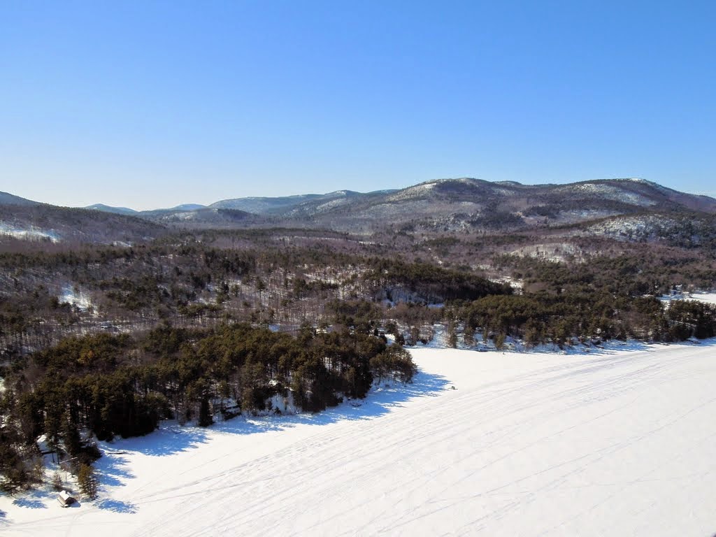
Vermont always passes quickly when travelling west to east by air. In spite of their name, the Green Mountains near Rutland were seasonally gray.
Yo, Taxi!
 |
| Laconia with Lake Winnipesaukee in the background |
Lake Winnipesaukee is a massive lake in central New Hampshire that boasts approximately 288 miles of shoreline owing to an amorphous shape and a multitude of islands (258+). Winnipesaukee extends pseudopods in many directions and the prominent one stretching to the southeast contains Alton Bay.


On approach to Laconia, I flew past many islands stranded in the ice; mountain tops projecting above a frozen stratus layer.

In configuration, Laconia Municipal is the product of a curious evolution. It is predominantly oriented east/west(ish) with most structures aligned along both sides of the runway. However, a former crosswind runway extends to the north that now serves as a ridiculously wide taxiway through no man's land to facilities otherwise isolated from the rest of the airport. Being so far off the beaten path might explain why those who willingly taxi to these northern boondocks are rewarded with $4.35/gal self-serve avgas from Emerson Aviation (score!).
 |
| GPS track from Emerson Aviation to departure on runway 26 (GoogleEarth) |
From the fuel pump at the northern end of the field, I programmed Alton Bay into the GPS and noted a direct distance of 10.5 nautical miles. Once the Warrior and I waddled to the departure end of runway 26 (I challenge you to name any airplane that is truly graceful while earthbound), I saw that the distance to our destination had shrunk to 9.6 miles. We had taxied nearly 10% of the way to Alton Bay!
Slick

I followed a meandering path along the shore to reach Alton Bay. There was no mistaking the location of the ice runway.

The runway often has a parallel taxiway, but frequent snowstorms over the past weeks have made it difficult for the volunteer team to clear everything. Priority, of course, goes to the runway itself and the parking area. Clearly, some recent progress had been made on the taxiway, but there was more work to do.

The runway is oriented as 1/19 with runway 1 being the preferred calm wind runway. It is about 3,000' long and 100' wide. Once officially open, the DOT marks the outline of the runway with yellow cones just like the ones commonly used to visually define grass runways in Michigan.

This unusual airfield shares the bay surface with snowmobiles and ice fishermen whose enclosures sit beyond the runway boundary. We called these structures "ice shanties" in Michigan, but they are known as "bob houses" in the local vernacular.

On final approach to runway 1, the "bob houses" were visible dotting the ice west of the runway. After making a ridiculously short landing on Laconia's 5890' runway that morning, I was high on final and touched down much farther from the ice runway threshold than I would have preferred. Still, with full back pressure on the controls to provide aerodynamic braking, I was stopped well before the runway end without using my brakes (which would not have been useful anyway). The basic premise of landing at Alton Bay is no different than winter landings at Le Roy in the days before the runway was lengthened beyond 2,600'; if you can't land and stop in the available distance without using your brakes, this is not the airport for you.

An odd translucence of the surface gave unequivocal evidence that no solid surface lurked beneath this runway.
 |
| GPS track of ice runway landing plotted in Google Earth (east is up). The yellow push pin icon marks where I parked. |
I plotted the landing in Google Earth as a way of saying, "yup, I just landed a Warrior on the surface of a lake!" After all, one usually needs floats, skis, or bushwheels (depending on season and surface) to accomplish such a feat.
"Living the Dream"


Pilots who land at Lake County Airport in Leadville, CO receive a certificate from the FBO recognizing the accomplishment of navigating to and landing at the highest elevation public use airport in the United States. Alton Bay offers an analogous certificate of achievement. Lacking an airport FBO, however, these certificates are distributed at Facet Jewelers by Donna LaRochelle, wife of airport manager Paul. Though famished, I chose to visit Donna before seeking lunch.

As I picked my way across a thawing and muddy parking lot, a passing car suddenly veered directly at me, a window powered down, and a harried-looking driver pleaded, "can you tell me how to get back to I-93?"
"Uh..." I began. Off to a good start so far. "Sorry, I'm not familiar with the area. I just landed here." Rather than attempt a verbal explanation, I pointed to where my airplane sat in the middle of the bay.
"What?" asked the driver, his brow wrinkling in further consternation. Then his eyes shifted to Alton Bay's airplane parking area. "Oh!" he exclaimed, brightening. "That's cool!"
From within the car, I heard a faint echo of this exclamation from his wife. "That IS cool!"

When I entered Facet Jewelers, Donna was busy with a customer. The customer's husband gave me an appraising look followed by a knowing smile when his eyes settled on the P-38 silhouette on my hat. "Out living the dream, eh?" he asked with a friendly smile.
Everyone I met in Alton Bay was very friendly and welcoming. "Where did you fly in from? How long did it take? Which airplane is yours? What kind of an airplane is it? Is this your first visit?" Refreshingly, the locals seemed excited about the airport. Businesses along the bay prosper in that the airport attracts pilots (who spend money) as well as the curious who want to watch airplanes land on the ice (and, of course, spend money).

I chatted with Donna for a time. It was clear that the ice runway demanded a lot of time and energy from her husband, but she appeared to genuinely enjoy meeting visitors brought to Alton Bay through her husband's efforts. She related an anecdote of two helicopters making a five day journey from California to the East Coast that landed at Alton Bay while in the region. One annual visitor takes a commercial flight to Boston where he rents an airplane solely for the purpose of flying in. I received my personalized certificate from Donna, bought a "B18 Ice Runway" hat, and signed the visiting pilot register.

Shibley's at the Pier has a direct view of the airplane parking area and I enjoyed a late lunch there. Were it not for the airport, I suspect that the restuarant would have been empty at this odd afternoon hour. Of the four tables along the bay side windows, three were occupied by fly-in visitors. Seated at a fourth table next to mine was a former aircraft owner and Huey pilot who had driven with his wife to Alton Bay specifically for the spectacle.
As she seated them, I heard the hostess excitedly explain to my neighbors, "if you sit here, you'll have the best view of landing airplanes. Now, the people sitting in that corner came in that airplane and the man next to you arrived in that blue and white airplane down there!"
For lunch, I devoured a haddock sandwich with cole slaw, both entirely satisfying. As I ate, I enjoyed the view. I watched a taildragger (a Cessna 170, I think) practically spot land at the runway threshold. Show-off.


As I was carefully navigating the ice parking area by foot, a helicopter arrived and landed nearby. I worried momentarily about losing my footing on the ice while being buffeted by rotor downwash, but I was not actually affected by it. I had brought my Yaktrax from the hangar in case I needed to move the parked Warrior on the ice, but did not use them.
 |
| Yup - it's ice. Perfectly solid, thick ice. That crack was already there, I swear! |
Back to Boring Old Pavement
Taxiing to the runway for departure, I waved to the driver of a newly arrived plow truck. I assume that this was Paul, but it might have been another volunteer. I was disappointed that I did not meet Paul to personally thank him for his leadership in maintaining such a unique place for aviators (and interested non-aviators) to enjoy.
After an abbreviated run up on the roll (recall that brakes are more or less useless at Alton Bay), I performed a normal take-off to the north over Lake Winnipesaukee.
 |
| Gunstock Ski Area south of Lake Winnipesaukee |
Once clear of the nearby terrain, I turned on course and contacted Boston approach for Flight Following home.

To the north, a massive, white-capped mountain dwarfed all others. Despite being over 40 nautical miles away, there was no mistaking Mount Washington.

Westward, the Green Mountains continued to fail at living up to their name.
Over the Adirondacks, I was called by an AirTran flight crew (funny, I did not realize that AirTran call signs were still in use). I either failed to hear a hand-off (it seems unlikely, I was not exactly busy) or was out of range when Boston Center called with the frequency of the next sector. Either way, air traffic control relayed the next frequency to me through an airliner up in the flight levels. Though I have overheard such exchanges in the past, it was my first time as the subject of one.

Most of the route home was clear of clouds, though some cumulus floated above my cruise altitude as I crossed the southern Adirondacks. Not unexpectedly, there was quite a bump under each one. Cloud cover also lingered near Syracuse. Beneath the deck, ice particles churned in the air, reducing visibility and reflecting the sunlight in an inverted sun pillar (above photo).

Deep Freeze

Ice on the surface of Lake Ontario extended beyond the limits of perception to the west.


Compared to the smooth surfaces of the bays, the ice on Lake Ontario exhibited obvious evidence of the more turbulent water in the Great Lake.
Back at Williamson-Sodus, only a single set of airplane tire marks marred the remaining snow on the runway. They were mine, as verified by Helicopter Ray (my daughter's nickname for him) in the maintenance shop who confirmed for me that Warrior 481 was the sole airplane to operate on the field all day. One of the more senior club members appeared at the nose of the airplane offering to help me push her back inside the hangar. He was better dressed than I for the low temperature and brisk Sodus wind in his Carhartt overalls.
"I'm jealous, you know. You keep sneaking off to fly and none of the rest have us have been out for a while," Denny said.
Yes, it was cold and windy, but well worth it for a bit of adventure and a new experience. The fellow in Alton Bay was absolutely spot on. I am just living the dream. My heartfelt thanks go to Paul LaRochelle for all he (and his fellow volunteers) have done to provide such a novel destination for us dreamers.
Definitely on my bucket list, though the complications of necessary time and weather to make it up there this time of year are a bit complex for me. So I'll continue to enjoy living vicariously thru your adventure for now!
ReplyDeleteYour comments about the snow at FZY remind me of the first time I flew at Stewart after it snowed about 6 years ago. By that time I was quite familiar with the local area and landmarks but I distinctly recall flying a few miles out then turning back and wondering, "where the heck did the airport go?!" It's amazing what a little snow does to completely change the sight picture and ability to spot landmarks from above.
Funny you mention the ATC relay - I was asked to do that once over the UP somewhere west of St. Ignace. Only I was playing the role of contacting the airplane the controller couldn't reach. Yet another neat little way aviation is such a small, generally helpful-to-each other community.
It should be on your list! This place just screams "cool place to land a Cub". Now, of course, I realize that the distance is relatively great, especially with the weather at this time of year (heck, it took me about three years to finally find my way over there), but it would be so cool!
DeleteIt's interesting that you brought up the changed appearance of the landscape after it snows. I used to feel every winter as though I needed to go through a mental adjustment just to recognize familiar areas once they covered with snow. I don't feel that way as much anymore. I wonder if I finally have enough winters under my belt that the adjustment happens more readily?
It could be a learned experience thing for sure. My first snow flight was a few months after my checkride so I - unlike the terrain - was still quite green.
DeleteNote that grass strips blend in even better than concrete, too!
Awesome pictures and write up, thanks for sharing. I admit, I am also living vicariously thru your adventures. Great bucket list item!
ReplyDeleteA few BAC members head out every year, maybe next year I'll join in the fun.
You'll be back in the air before too much longer, right? As far as this one goes, if you're going to suffer through winter, you might as well have some fun along the way!
DeleteThanks for sharing. Will try to go there next week...
ReplyDeletehttp://dirk-ppl-a.blogspot.com