Pages

Sunday, August 20, 2023

Nocturne

It was not my intention to fly home in the dark. But after a day of reuniting with cherished friends and family, I was in no hurry to depart southeast Michigan. Driven by the cold machinations of the heavens, sunset waits for no one.

Broken Connections

I spent the first 22 years of my life in southeast Michigan, but most of my time on Earth has been lived elsewhere. I have many friends and family in that part of the Mitten that I do not see as often as I would prefer. Losing my mother in 2018 further severed those connections, both because she kept me involved with the family and because I found myself making far fewer visits home without her there to welcome me.

On August 3, my cousin Barb's husband Tony was involved in a fatal motorcycle accident near Sturgis, South Dakota. I liked Tony. Though we had exactly zero things in common, whenever I attended a family gathering, he always made an effort to check in with me to see how I was doing. For many years, Barb and Tony hosted Mom's side of the family at their house for Thanksgiving. They are a half generation older than me and one of my early memories is attending their wedding as a little kid where I danced the night away like a goofy fool with my best childhood friend, Rob. It was clearly an event that occurred before I developed any form of inhibitory self consciousness.

For that matter, I had not seen Rob in over 20 years, another connection broken with time and distance. As kids, we spent every summer day together scheming and building new things, our imaginary adventures every bit as fantastical as those of Phineas and Ferb (but without the teal, shoe-box shaped platypus). Not surprisingly, most of those adventures involved a lot of purely imaginary flying.

When I was invited to Tony's Celebration of Life on August 20, no one from the family genuinely expected me to make an appearance. However, with an airplane, such feats are easily accomplished.

Back to the Mitten

Date Aircraft Route of Flight Time (hrs) Total (hrs)
20 Aug 2023 N21481 SDC (Sodus, NY) - PTK (Waterford, MI) 3.1 2708.4

At the fuel pump in Sodus preparing for departure.

I flew to my hometown against a 30 knot headwind that stretched the flight time to just over three hours. Considering that the drive time is reliably six hours, even a slow flight is unquestionably an improvement over a fast car. Stress is also a factor and there is something to be said about lounging in a mostly deserted sky with HAL controlling the airplane and shoes comfortably kicked off versus navigating the crowded mad rush of traffic on the QEW.


Over the years, I have developed an odd relationship with Niagara Falls. Many pilots fly from far away just to get an aerial peek at the Niagara River tumbling over its escarpment. What is a bucket list item for some pilots is just one of many landmarks on the flight home for me. I always enjoy seeing the falls, but every time I capture a photo I think, "Well, that looks just like the last photo I took." Yet I keep taking them. I do not know what I am searching for, but I hope to recognize it when it appears.

Haze over Ontario, Canada.

Michigan Aviation, my go-to FBO at Oakland County International, remains generous with their courtesy cars. The facility received a significant facelift in the years since I partially lived there in 2018, but what really makes the place feel different is Scott's absence. For years, Scott marshalled me to parking there and always greeted me by name. He made me feel like I belonged whenever I returned to my hometown airport. Now that Scott is retired, I am just another unknown transient pilot. But at least they still loaned me a car for the day.

I had lunch at one of my favorite places, Parker's Hilltop Brewery. From there, I checked in on Mom's former house, visited with Greg's parents, and successfully navigated by memory to the hall in Oxford hosting Tony's celebration.

Barb was stunned to see me. Being able to support her in that moment made the entire trip worthwhile. I reunited with other family members, including my wonderful cousin Jerri. She was a teenager when I was a little kid, but always made time for me. During Mom's final days, when I put a call out to the family inviting over anyone who wanted to talk with her one last time, it was Jerri who came with my aunt. I caught up with several relatives that I had not seen in many years and even managed to impress some friends of the family by remembering their names despite not having seen them in decades.

Before departing New York, I reached out to my childhood friend Rob and shared the news about Tony and the celebration happening in his memory. Barb was Rob's babysitter when he was young (back when she was still known as Barbie and he was still known as Bobby), which was why he was at her wedding with me in the early 1980s. We grew apart while I was in college and the last time I saw him in person was during my wedding in 1999, but with the swirl of people and activity around me that night I did not find time to sit down and talk with him. I was delighted to see him again and to meet his sixteen year old son for the first time. My reunion with him was bittersweet as I learned that his youngest sister Raquel -- who used to pester and chase after us when we were kids -- died unexpectedly in 2022.

After leaving the event, I met my dear friend Kristen for dinner. Despite passage of many years since we last met in person, we connected as well as we always had, as though our last meeting occurred mere days before. Seeing her caused me to reflect fondly on the summer after high school graduation when we often went to the local Big Boy (the only sit-down restaurant in town that fit teenage budgets) and I regularly made her laugh loudly enough that the manager used to scurry over and threaten to throw us out. Good times.

Despite the tragic event that precipitated my trip, reconnection with so many friends and family that day was nourishing to my soul. Although my focus in coming was to support Barb and the family, that support was generously reciprocated. It was a day-long embrace by family and friends that I did not consciously recognize needing prior to making the trip.

Halo

I love it when Pontiac Tower overrides the FAA computer that assigns IFR routes to give me what I asked for instead of the problematic default routing over the waters of a Great Lake. All it takes is a note in the flight plan "requesting no route across Lake Erie" to catch a human's eye and inspire intervention. Thanks guys, as always.

Date Aircraft Route of Flight Time (hrs) Total (hrs)
20 Aug 2023 N21481 PTK (Waterford, MI) - SDC (Sodus, NY) 2.5 2710.9

The sun was setting as I sped down Oakland County International's runway 27L and took to a sky suffused with a ruddy evening glow. Detroit Departure provided radar vectors out of Oakland County's delta airspace before clearing me to the approved route. By the time I crossed into Canada, the landscape ahead was cloaked in darkness with the western horizon at my tail dimly radiating twilight's residual warmth. Near London, Toronto Center offered a direct route to Sodus that eschewed the longer airway route that I was following. I genuinely love flying after sunset and swimming through the calmed air after nightfall. Radio chatter diminishes and becomes tonally gentler, as though the brusquely staccato delivery of daytime communications might offend the peaceful darkness.

Photo of my right wingtip while flying through clouds at night over St Catherine's, Ontario.

Reaching Hamilton, civilization's terrestrial constellations flickered as intervening clouds blocked their light from below. East of Hamilton, I became engulfed in the clouds entirely. It was my first time conducting an extensive flight through clouds at night. The experience was magical. I switched off the strobes and marveled at the hypnotic way the Warrior's navigation lights fluttered and danced on the wingtips as they sliced through the inhomogeneous surrounding vapor. I was my own light show, my airplane enveloped in a misty halo of diffusely reflected exterior lighting. Over the Niagara River, I momentarily emerged on top of the clouds, flying through a phantom range of gauzy mountains that were vaguely discernable in sepia tones against the darkness, barely illuminated from within by attenuated rays reaching through the deck from city lights below.

Because of trees encroaching on the final approach courses, nighttime instrument procedures are no longer authorized at my airport. Though I remained within the clouds for the rest of the flight home, roughly 0.7 hours, the 4,000 foot ceiling over the Williamson Sodus Airport was high enough that no instrument procedures were needed that night. However, even for visual flying, those trees have become a hazard at night due to the visual glideslope lighting system being temporarily out of service. Without guidance, I flew a high and steep approach to runway 28 to ensure clearance with the treetops lurking invisibly in the darkness. Imperceptible except for points of light outlining its perimeter, the runway grew larger in my windscreen, its defining pixels spreading apart then flattening as I approached, the view briefly recalling the crude graphics of a 1980s flight simulator. Once close enough for the Warrior's landing light to illuminate the piano keys and other runway markings, that particular illusion gave way to physical reality and I rolled the airplane's wheels onto the pavement.

I landed at 10:40 pm, much later than I originally planned, but content that my tardiness was for all of the right reasons.

Thursday, August 17, 2023

Inclement Beauty

DateAircraftRoute of FlightTime (hrs)Total (hrs)
17 Aug 2023N21481SDC (Sodus, NY) - DSV (Dansville, NY) - SDC1.52705.3

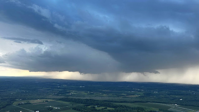
In recent years, a popular after-work activity for the Williamson Flying Club is a brief flight south to Dansville Municipal Airport in Dansville, NY for ice cream from Ice Cream Island. We had five airplanes make the trip on August 17. Bob C, another club member, flew right seat with me for the first time. It is a rare event when ice cream is not the focus of this kind of flight. Instead, a series of isolated rainstorms took center stage. Easily circumnavigated, the cells painted the sky with amazing beauty. 


Small cells were moving northbound toward Sodus as we prepared the airplanes for flight. We waited out a light rain shower as one passed, witnessing this double rainbow from my hangar.


In the air, another cell was advancing steadily on Sodus, but we maintained our distance on the way to Dansville.


FlightAware flight track with the weather shown as it existed roughly midway through the flight.


Sunday, August 13, 2023

Bears in Blue Ridge | Part 3, Down with ODP

Saturday, August 12, 2023: You Down with ODP? (Yeah You Know Me)

Our final morning in Blue Ridge was a harried frenzy to dispose of leftover food in a way that minimized its likelihood of being intercepted by the rogue bear on our mountain. I cooked eggs for breakfast to keep them from going to waste. I absolutely hate wasting food.

A Dunkin' in Jasper, GA made for makeshift flight planning space as we waited on fog to lift at Pickens County Airport. While I anticipated an IFR departure that morning, I wanted to see ceiling and visibility of at least 300 feet and a mile to avoid smacking into mountainous terrain around Pickens County Airport during take-off.

Tools available to me for terrain management included ForeFlight's Hazard Advisor, the Warrior's onboard GNS-430W terrain display page, and the airport's obstacle departure procedure (ODP). The ODP was a key element of my departure strategy, but I also filed to IPECA, the missed approach fix for the instrument approach to the runway we would use that morning. The direct route from our departure runway (34) to IPECA would also help manage terrain.

Before too long, the visibility rose to unrestricted while the ceiling remained around 300 feet. This was high enough to fly the RNAV-34 approach back into the airport if needed and meant that we were a "go" for launch.

Swift Departure

Date Aircraft Route of Flight Time (hrs) Total (hrs)
12 Aug 2023 N21481 JZP (Jasper, GA) - DKX (Knoxville, TN) 1.5 2698.9

A pair of powered parachutes were operating low under the ceiling at Pickens County, launching and landing from a short grass strip orthogonal to the main runway.

Low clouds breaking up over Pickens County Airport.

As we readied the Warrior for flight, holes began to appear in the cloud deck that revealed the layer to be relatively thin.

"Pickens County traffic, Execjet 123 is on the RNAV-34 approach, Pickens County." "Execjet" is the callsign used by NetJets and the pilot's intentions were broadcast across the ramp by loudspeaker. A pair of women waiting at the operations building had chartered the private jet.

As I finished loading our baggage into the Warrior, a loud roar overhead announced the jet going missed on the approach. This was puzzling because the ceiling should have been high enough for the pilot to acquire the airport visually at minimums. Either way, we never saw the jet go overhead in the clouds, we only heard it. 

At the operations building, the two women were distressed by their pilot's failure to land. Kristy overheard one of the local airport bums providing an excellent layman's explanation of weather minimums and missed approaches to help the waiting passengers understand what just happened. The weather was visibly lifting and he assured them that their chartered aircraft would return.

We taxied to the end of runway 34, ran the airplane up, then called Atlanta Center on the phone to get our instrument clearance from the ground. Normally, I would have worried about blocking the entrance to the runway while waiting for IFR release, but it was still early in the morning and not particularly VFR, so I assessed the risk of being in anyone's way to be negligible. (Famous last words.) I suggested to Kristy that we might have to wait for release because the NetJets plane was still IFR and trying to get in.

Example of a Globe Swift photographed 11 August 2018 at the Oswego County Airport (KFZY).

On the phone with Atlanta, I was immediately put on hold. As I waited, a pair of Globe Swift aircraft taxied up behind me for departure. Because there was no run-up area, I was on the taxiway and effectively blocking their access to the runway. The only reasonable option was for me to taxi onto the 100 foot wide runway, let the two low wing speedsters pass by, then return to the taxiway. Naturally, Atlanta Center came back to me on the phone while I was in the midst of accommodating the Swifts and I asked him to standby for a moment. The Swift pilots expressed their gratitude over the radio, zipped down the runway in formation, and quickly disappeared from view.

Despite strong cell signal, the audio quality from Atlanta Center was poor and I struggled to understand the controller. After asking him to repeat himself several times, my clearance was granted as filed for immediate release from runway 34. I was surprised by the lack of delay. Where was NetJets?

In Through the Out Door


As we climbed through the cloud layer on the ODP, Execjet 123 was being vectored north of the airport. Because I was filed to IPECA (the missed approach holding fix for runway 34 northwest of the airport), Atlanta Center kept the jet clear of our flight path and had obviously (to my utter surprise) prioritized our departure over his arrival. I wondered if the NetJets pilot had annoyed the Atlanta Center controller. I also wondered if Atlanta Center had slam dunked Execjet 123 with a steep descent from VIVIC like they did to me the day before and if that was the cause of the missed approach in the first place.

Reaching IPECA, now flying in clear air and having avoided all relevant terrain, we confirmed visual sighting of Execjet 123 with Center and turned northeast direct to Knoxville Downtown Island Airport. At this point, a series of baffling transmissions commenced between Execjet 123 and Atlanta Center.

"Execjet 123, proceed direct IPECA for the RNAV-34 approach, Pickens County Airport." The NetJet pilot read the clearance back haltingly because it didn't make any sense to him. It did not make any sense to me, either. While IPECA was an initial fix for the RNAV-16 instrument approach, it was only part of the missed approach procedure for RNAV-34, not part of the approach procedure itself. It was one of those "you can't get there from here" situations and suggested that the Atlanta controller had mixed up initial fixes for the reciprocal runways.

On reaching IPECA, the NetJets pilot was cleared for the RNAV-34 approach...from a fix that was not part of the procedure. How was that going to work? The pilot accepted the clearance, but with a similar, halting cadence betraying his inner confusion. Obviously, the pilot assumed that ATC's nonsensical instruction must eventually make sense if he thought about it long enough.

"Atlanta Center, Execjet 123 requesting a delay vector while we sort through this approach." 

"Good plan!" I exclaimed to Kristy. The NetJets pilot was buying time to understand ATC's confusing directive. Eventually, he would realize that the mistake was on the controller's end.

"Execjet 123, I don't know what that means," responded Atlanta Center.

"WHAT?!" exclaimed Kristy. Even my non-pilot wife completely understood what the NetJets pilot was trying to do. Delay vectors are standard phraseology and can be requested by pilots needing ATC to send them on a safe trajectory away from conflicting terrain or traffic while they work through an issue. It is all about buying time while hurtling through the air.


After some additional back and forth, Execjet 123 was eventually cleared to VIVIC (the actual initial approach fix for the RNAV-34 approach) at 4,200 feet (better than 6,000) where they flew the holding pattern (procedure turn) to get turned back around toward the airport. Hearing them cleared for the RNAV-34 approach into Pickens County and being passed to the advisory frequency caused me to utter a sympathetic sigh of relief. All was eventually right with the world and, presumably, the two passengers waiting in Jasper eventually got to where they were going.

It was one of the most baffling exchanges with Air Traffic Control that I had ever overheard. (Except, perhaps, for the Sikorsky Incident earlier this year.) After being handed-off to Knoxville Approach and checking in, Kristy and I just looked at each other in amazement.

"Wow," we said in unison.

Swift Day

Emerging from the clouds north of the Smokies east of Knoxville with the French Broad River visible.

A mere hour after departing Pickens County, we were flying the RNAV-26 approach to our Tennessee home away from home, Knoxville Downtown Island Airport. We planned an overnight visit with Dad and Carol before returning to New York. With our last visit being in 2021, we were very overdue.

Knoxville Downtown Island Airport photographed 17 July 2021.

On the ramp, we were met by an enthusiastic, newly-minted pilot who had flown to Knoxville from northern Georgia to enjoy some plane spotting.

At the fuel farm with the skyline of Knoxville, TN in the near distance.

"Your landing was great!" he exclaimed in greeting. Honestly, it was actually pretty good. That crazy landing at Pickens County two days earlier seemed to have broken a streak of crummy "thumper" landings from the past two months. Then he pointed to a shiny, sleek-looking low wing aircraft launching from runway 26. "What kind of airplane is that?"

"It's a Swift," I responded wryly. Swifts are not very common and it was unusual to see three in one day.

My awesome ground crew comprised of Dad and Kristy.

With Dad and Carol, we explored the new house they were having built (I have lost track of how many new houses they have built since moving to Tennessee), got some cinematic closure on our last visit by watching Guardians of the Galaxy 3, and enjoyed pizza from Dad's favorite pizzeria for dinner. It was good to catch up with them.

Sunday, August 13, 2023: Grove City

DateAircraftRoute of FlightTime (hrs)Total (hrs)
13 Aug 2023N21481DKX (Knoxville, TN) - 29D (Grove City, PA) - SDC (Sodus, NY)4.92703.8

The meandering Ohio River separating West Virginia from Ohio.

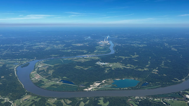
With an IFR departure from the island and a climb through a low ceiling over the Tennessee River, we cruised northeastward in clear air at 7,000 feet. Our route encountered the meandering Ohio River again. Much like the trip south, the journey home was easy and I was content to let HAL fly the plane while I kicked off my shoes and gave my toes a stretch.


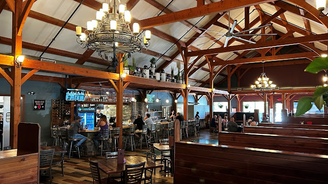
We let down into Grove City, PA (29D) for lunch at TimberCreek Tap & Table, a brewpub adjacent to the airport. My first visit there was in June when I arrived with a group from the Williamson Flying Club to check it out. Tap & Table has a reasonably diverse menu of hearty, glorified pub food. Other attributes of Grove City include an active skydiving operation at the airport, a large outlet mall that draws shoppers from all over the region, and dreadful cellular signal. Signal was so poor at the restaurant that I could not even pull a METAR from home. It was like being back on Tangier Island.


These are not fancy designer propellers. The local skydiving outfit had a gear-up landing incident with their King Air. At least it is a turboprop and prop strikes do not automatically require an engine teardown and inspection. Regardless, the condition of those propellers probably led to a difficult conversation with the pilot.

TimberCreek Tap & Table photographed June 2023.

TimberCreek Tap & Table photographed June 2023.

Lunch was good. It may have been glorified pub food, but it was good glorified pub food. Because most brewpubs showcase their brewing equipment, I was surprised not to see any evidence of the physical microbrewery on site.


Then I found it. Apparently, I just needed to look down. 

A Kodiak leased to the skydiving operation while the King Air is down.

Refueled and recharged from an excellent lunch, we fueled the airplane before departing Grove City. Running through the clouds on the way home, we were fortunate to earn peeks of the beautiful landscape below framed by the cumulus.

Sightseeing

The Allegheny Reservoir on the New York - Pennsylvania border.

Rushford Lake in Western New York. The arrowhead always points toward home.

A Finger Lake! Conesus Lake, to be specific. Almost home.

Remarkably flat cumulus bottoms on the descent into Sodus.

Recap

This year's SurnameFest expedition added 13.8 hours to the logbook, including 1.9 hours in instrument meteorological conditions with one instrument approach logged (Pickens County Airport) and two IFR departures (Pickens County and Knoxville). We added two new airports to the map (Jackson County and Pickens County) while returning to one of our most frequently visited out of state airports, Knoxville Downtown Island Airport (appearing in my logbook 12 times). We saw "tiny dinosaurs", grilled under umbrellas, cruised around in a very purple Charger, learned a valuable lesson while mitigating a hail storm, had an encounter with a ravenous bear that we did not bring with us, reconnected with Kristy's family plus my Dad and Carol, played a lot of Mario Kart, enjoyed Boston Coolers, and learned where not to stand in the Pickens County Airport operations building. 

All in all, a good trip!

Friday, August 11, 2023

Bears in Blue Ridge | Part 2, Slam Dunk into Jasper

Personal Growth

For me, part of aviation's appeal comes in the form of opportunities to challenge myself, experience new things, and grow. Sometimes, growth comes in the form of critically evaluating performance, learning a new lesson, and finding a better way. Our vacation in Georgia this summer offered a memorable example of such a growth opportunity.

Monday, August 7, 2023: "Oh, Hail..."

When it comes to light aircraft, there are few things that strike fear in the hearts of owners quite like the threat of hail. Shy of a hurricane or tornado, the Warrior can easily tolerate most weather phenomena experienced while parked outdoors in her cabin cover. But hail is in a league all its own and only a hangar can protect against that. The Warrior was already subjected to hail on my watch during a stop in Kennesaw, GA in 2011 when I watched helplessly as tiny chunks of ice pummeled my airplane. Fortunately, the hail was small and the damage minor. No one wants the skin of their airplane to resemble a dimpled golf ball, Pollyanna commentary about drag reduction aside.

Two days into SurnameFest, a credible hail risk was forecast for the entire area. Starting with Pickens County, I called every small airport in the region looking for hangar space. Nothing was available. Finally, I called Hawthorne Aviation at the Cobb County Airport in Kennesaw, GA, a towered general aviation airport on the northwest quadrant of metropolitan Atlanta. I learned that I could overnight there in a hangar for $65. Sold! I told them to expect me within a couple of hours.

Warrior 481 (seen between the pillars) caught out in a massive thunderstorm that eventually led to hail on 15 June 2011 ay KRYY.

Ironically, Cobb County Airport is the very place where Warrior 481 experienced her last hail storm. At least this time, she would be under roof.

Repositioning Flight

In the end, repositioning the airplane became an activity for half the family. Terry, Nate, Kristy and I departed together from our mountain abode on a mission of preemptive airplane rescue. Kristy and Nate dropped me and Terry at Pickens County Airport, then continued southbound to retrieve us from Cobb County Airport. 

Inside the Pickens County operations building, Terry and I encountered Randy, boisterous airport manager extraordinaire. We caught him in the midst of a discussion about the deteriorating structure.

"Well, we moved the couch under the bulletin board so that no one reading it could stand where they would fall through the floor," Randy said. Noticing my grimace, Randy pointed to a nearby door with a no-admittance sign on it. "The floor is even worse in there. No one goes in there."

I introduced myself and reminded Randy of our conversation about rental cars from a few weeks before. He asked how Enterprise did and I gave them high marks. I explained that we were relocating the Warrior due to the coming storm, but that we would be back later in the week.

Though only two days elapsed since arriving in Georgia, the Warrior had already weathered multiple rainstorms. I discovered evidence of this in the right fuel tank, which contained a significant volume of water. I spent several tedious minutes removing water from that tank, silently thanking the inventor of the GATS jar for making it possible. Happily, fuel in the left tank was completely dry. Though I was confident that my efforts with the right tank had removed all water, I planned to launch on the left tank just in case.
 
Date Aircraft Route of Flight Time (hrs) Total (hrs)
07 Aug 2023 N21481 JZP (Jasper, GA) - RYY (Kennesaw, GA) 0.5 2696.7

As the crow (or airplane) flies, Cobb County Airport is only 27 nautical miles from Pickens County. Terry joined me for the repositioning flight because he was intrigued by the Warrior's new(ish) avionics and wanted to see them in action. Unfortunately, it was going to be a short hop that would not allow for much of a demonstration. Within moments of departing Pickens County, we were on with Atlanta Approach and, shortly thereafter, handed off to McCollum Tower at Cobb County.

Cobb County was moderately busy and the controller capably sequenced us in for landing. Terry commented that it was the most ATC chatter he had ever heard while flying with me. The line crew from Hawthorne marshalled us to parking at what appeared to be the exact spot where Warrior 481 rode out her last hail encounter. My agreement with Hawthorne was that the Warrior would spend the rest of that day and night in their hangar, but that they could tie her down outside afterward until I returned. To that end, I bundled the airplane back up in her pajamas.


Emerging from the FBO, I received a vivid reminder of our 2011 visit by returning to where we took shelter under the overhang at the Elevation Chophouse. We waited an hour for a ride to the hotel that night, The Bear cowering against me as the thunderstorm raged around us, thunder roaring, lightning searing the bruised sky, and ultimately hail pelting downward from the heavens. Despite a beautiful clear day in 2023, strong visual memories of that storm readily overlaid contemporary reality.

Content that the airplane was in good hands, we returned to Blue Ridge. That afternoon, severe storms swept through northern Georgia as forecast. I do not know whether Jasper actually received hail or not, but that is a moot point. (And a bit of a Schrodinger's cat scenario.) $65 was money well-spent for peace of mind.

Friday, August 11, 2023: Logistics

At the end of SurnameFest, our purple Charger would have to go back to the Pickens County Airport and, once without a car, we would need access to the Warrior to fly home. This meant that the airplane had to return to Jasper before our vacation was over.

On Friday morning, we departed Blue Ridge in the Charger and drove two hours south through the rain to deliver Izzy to Hartsfield International for her flight home. Returning north, we stopped for lunch at a Kennesaw Mediterranean restaurant before Kristy and The Bear dropped me at Cobb County Airport to fly the Warrior back to Pickens County. It was the perfect opportunity to reposition the plane considering that we were already driving through the area.

At Hawthorne Aviation, the FBO staffer noted that I had been parked there four nights with one of those in the hangar due to the storm. Kindly, she waived the $65 hangar charge and I was only billed for four nights of tie-down at $25/night. That was a pleasant surprise from a big corporate kind of FBO at a big corporate kind of airport.

I walked to where the Warrior was tied down on the edge of the ramp with mild apprehension. The entire route to Pickens County was under IFR conditions with low ceilings. While I have become quite comfortable flying instrument approaches, I am not used to doing so in mountainous regions where the stakes are much higher. I had spent much of lunchtime obsessively reviewing details of the short IFR flight to Pickens County.

I removed the cabin cover, stowed the chocks, pitot cover, and cowl plugs, then set about inspecting the airplane. Though Monday's storm was the only one forecast to pose a significant hail threat, it was not the only example of severe weather that week. Sumping the right fuel tank -- the one contaminated with water at Pickens County -- I was relieved to recover only dry fuel. Moving to the left tank, I discovered significant water contamination in the formerly dry tank. How did that happen? With sweat running into my eyes, I repeated the tedious exercise of removing all water from the fuel.

IMC in the Mountains
 
DateAircraftRoute of FlightTime (hrs)Total (hrs)
11 Aug 2023N21481RYY (Kennesaw, GA) - JZP (Jasper, GA)0.72697.4

Still dripping in sweat from the humid Georgia air, I was swallowed up into the bottom of the clouds within moments of departing Cobb County Airport. In cruise, I enjoyed a few brief glimpses of blue sky while among the ragged cloud tops. After the switch from McCollum Tower to Atlanta Approach, I was prompted for my approach preference at Pickens County and requested the RNAV-34.

"Cherokee 481 is cleared direct VIVIC, climb and maintain 6,000 feet."

RNAV-34 approach procedure at Pickens County Airport.

Closer to VIVIC: "Cherokee 481 is cleared for the RNAV-34 approach at Pickens County. Maintain 6,000 until crossing VIVIC."

Herein lay the problem: a mere 5.9 nautical miles were available to descend from 6,000 feet to the 3,200 foot glidepath intercept altitude at CICCA (note the procedure, above). I established a more aggressive descent rate than the usual 500 feet per minute, but was still too high upon reaching CICCA. A back of the envelope calculation shows that I required a descent rate of nearly 900 feet per minute to meet the altitude target at CICCA. Despite subjectively plummeting among the mountains relative to my usual flight envelope, the descent I flew was still not steep enough.

ForeFlight track log from Cobb County Airport to Pickens County Airport.

Passing CICCA, still in IMC, I pulled the throttle back farther to increase vertical descent rate and decrease forward airspeed toward a runway lurking somewhere ahead and beneath the clouds. It was to no avail and I watched the glideslope indicator slide gradually toward the bottom of the instrument.

This meant that I needed to abort the approach and try again. 

Dammit. 

Before I could advance the throttle for a missed approach, there was a flicker through the windscreen and I emerged from the cloud deck into clear air with the runway directly ahead. I was roughly 900 feet above the runway surface and far too close to make a normal approach and landing. 

Now returned to VFR conditions in clear air, old instincts took over. I twisted the airplane into a power-off full forward slip and dropped toward the runway. It was the kind of steep, slipping approach I routinely used to land short on the grass behind the tree line at South Haven. As the asphalt expanded to fill my peripheral vision, I kicked the rudder, leveled the wings, and pitched the nose toward the horizon. Suddenly, the wheels were rolling without any bump announcing ground contact. It was the best landing I had made in months and I used less than a third of the total runway length to accomplish it.

Pickens County Airport was hosting a social event when I arrived. The operations building porch was lined with people in rocking chairs who gawked at the aircraft that had just dropped into their midst from the clouds. I topped off the fuel and dressed the Warrior in her pajamas. My clothes were soaked anew from a combination of climate and stress. 

Inside, the conference table overflowed with food. Randy was very intent on sharing this bounty with me, but I had no appetite. I was too full of falafel and adrenalin. "I ate before flying over," I offered weakly in an effort to fend him off. 

"But I just saw you out there working! Surely you have room now!" Pickens County Airport and its gracious manager cannot be faulted for a lack of hospitality.

One Good Turn

Even before touching down at Pickens County Airport, it was obvious to me how I should have handled this approach differently. As shown on the approach procedure, charted crossing altitudes for VIVIC range from 4,200 to 6,000 feet. VIVIC is also the fix for a holding pattern. Although I was not required to fly that hold (I arrived from the "NoPT" or "no procedure turn" direction), requesting it would have provided an opportunity to descend to 4,200 while negotiating the racetrack. This would have set me up for success by crossing VIVIC at 4,200 feet instead of 6,000 feet, allowing a comfortable descent rate of just over 300 feet per minute to reach the glidepath intercept altitude at CICCA. There is no guarantee that Atlanta Center would have granted this request, but because it is a charted portion of the procedure, the likelihood seems high. With five mile legs in the published holding pattern, a single turn would have sufficed.

As a student instrument pilot, the notion of intentionally requesting a hold would have made me blanch. In this case, the hold would have allowed me to lose altitude in protected airspace to set up for a safer approach flown with a normal descent profile. During instrument training, pilots learn that they can request the hold (or additional turns in the hold) to lose altitude. I should have made use of this tool to avoid that slam dunk approach into Pickens County.

Saturday, August 5, 2023

Bears in Blue Ridge | Part 1, Easy Pickens

A Full Decade of SurnameFest

SurnameFest 2023 in Blue Ridge, GA. Photo by Nate via UAS!

How do you stay connected when your family is scattered across the country? Weekly Zoom meetings are an option. A concerted effort to accomplish in-person visits is another. Kristy's family has pursued both approaches, with the latter epitomized by the annual "SurnameFest" gathering (name changed to protect the whimsical). SurnameFest began in 2013 at a rental home in Pigeon Forge, TN and has become a annual, if nomadic, event that has never been never held in the same place twice. (Some suggest that SurnameFest originated years prior in Jackson, MI, but because The Bear and I were not involved, we do not formally recognize this as its inception.) Past gatherings have been held in Florida, Michigan, North Carolina, Quebec, Tennessee, Vermont, and Wisconsin.

In 2023, we flew to Blue Ridge, GA to spend a week together in a mountain community. With only three exceptions, Warrior 481 has dutifully carried Kristy, The Bear, and I to our annual convocation. Exceptions were 2013 (Pigeon Forge, TN) when I decided that my brand new instrument rating was not up to the challenge of fatigue and weather conditions, 2016 (Cadillac, MI) when thunderstorms and tornado warnings aborted that flight, and 2020 that simply did not happen because of COVID. In contrast to these examples, the 2023 flight to SurnameFest was pure simplicity.

Cloud Strategy

Date Aircraft Route of Flight Time (hrs) Total (hrs)
05 Aug 2023N21481 SDC (Sodus, NY) - I18 (Ravenswood, WV) - JZP (Jasper, GA) 6.2 2696.2


A ragged cloud layer hung low over the Williamson Sodus Airport, but we climbed VFR through sizable gaps over Lake Ontario before turning on course above the clouds and picking up our IFR clearance with Rochester Approach. To some, negotiating the clouds VFR and going IFR in severe clear weather might seem like a backward strategy. However, the clouds north of the airport were truly manageable and did not warrant a phone call to the TRACON for clearance from the ground. Once in cruise, I prefer to be on an instrument plan for multi-state cross countries because it guarantees coordination with air traffic control and simplifies dealing with any clouds encountered along the way.


Level at 8,000 feet, we were treated to a whimsical vista of condensate over New York state.

The Bear providing great fodder for a caption contest.


Do these people look happy? It seems like they do, but I have my eye on the one in the back seat. Maybe she's just annoyed because my other Zulu headset was glitching out at the moment (it has since been repaired and upgraded to a Zulu 3 by Lightspeed) and she had to revert back to the ol' David Clark head clamp.

Flirting with the Ohio River


Owing to a straight-as-an-arrow trajectory southwest, our route crossed the meandering Ohio River multiple times.

"We're in Ohio!"

Minutes later: "We're in West Virginia!"

A few more minutes later: "We're in Ohio again!"

These in-flight announcements were of limited interest to my passengers and, given the striking (if welcome) lack of meowing from Guard Trolls that day, Kristy was left with no one to roll her eyes at but me.


Jackson County Airport (I18) as photographed on 13 August 2023.

We landed at Jackson County Airport (I18) in Ravenswood, West Virginia as a leg-stretching and refueling stop (airport #266). Jackson County's appealing attributes that morning included being halfway to our destination in Georgia, inexpensive self-serve fuel, good instrument approaches in case the weather was poor, and its overall appearance of being a hassle-free facility. We planned for a quick turn.

A large aluminum plant is sited west of runway 04-22 and boasts a substantial stack that must be avoided while flying a left downwind for runway 4. We landed in calm air, rolled to the end of the runway, and parked at the fuel pump. A young woman from the FBO appeared and helped with fueling. We had a quick restroom break in the nicely appointed, lodge-like FBO building before launching from runway 22 to resume our flight to Georgia. Our total time on the ground was less than 30 minutes. Quick turn accomplished!

Legacy of the TVA

Back at 8,000 feet, HAL doggedly toed the magenta line to Georgia while music played on the intercom. I kicked off my shoes and we enjoyed an in-flight lunch of sandwiches and grapes from Wegmans. I still think grapes are the perfect airplane snack: delicious, a modest source of moisture, bite sized, and crumb-free.


Entering Tennessee, we flew over Douglas Lake for the first time. Located east of Knoxville, the massive reservoir was created in the 1940s by the Tennessee Valley Authority and, based on the activity we saw on the water, is obviously a nexus for recreation.


Coincidentally, we flew right over the spot where the SurnameFest tradition really began: Pigeon Forge, TN. Seeing the traffic below revived lingering traffic density PTSD from that experience a decade ago. We have shunned highly populated areas for SurnameFest ever since.


I have often noted that the Great Smoky Mountains, a subset of the so-called Blue Ridge Province, generate their own weather.


That day was no exception as puffs of cumulous coalesced from the air directly over the mountains despite clear skies all around.


We passed the Santeetlah Reservoir in North Carolina, spillways on the dam actively working to adjust water levels. The reservoir is close to Robbinsville, NC where we stayed in 2019.

Closer view of terrifying water slides at the Santeetlah Dam.

Jasper, Georgia

Some thought went into deciding on an airport to base at for the week, though this was partially undone by weather after our arrival (more on that in the next post). Factors considered included proximity to Blue Ridge and ease of use during inclement weather. Initially, I considered Martin Campbell Field (1A3) in Copperhill, TN where we tied-down during the total eclipse of 2017. It is a nice facility, the manager is a great guy, and it is the closest public use airport to Blue Ridge. But it is also surrounded by mountains and rather remote. After being stranded by Enterprise in Plattsburgh, NY and Brunswick, ME in recent years, I wanted to ensure better access to rental cars. Chattanooga has the closest airport with rental cars on the field, but is farther from Blue Ridge than I wanted to park the Warrior. Gilmer County Airport in Ellijay, GA is the next closest to Blue Ridge, but is nonetheless surrounded by higher terrain and has a shorter runway. Pickens County Airport (KJZP), south of Gilmer County, boasted a longer runway, easier approaches with lower terrain, and conversation with airport manager Randy assured a good track record with rental car drop off.

Randy referred me to the local Enterprise office. "Call 'em directly, tell 'em Randy sent ya," he instructed over the phone. 

Pickens County Airport, Jasper, GA.

After clearing the Great Smoky Mountains, we overflew Pickens County Airport (airport # 267) and entered a left downwind for runway 34. The approach end of runway 34 is on a high bluff towering over an apartment complex. As much as living near an airport would absolutely delight me, even I would not have wanted to live in those apartments. I mentally directed a silent apology to the apartment dwellers below the final approach course as our shadow traversed their rooflines.

Once down and stopped at Pickens County (or, as pronounced by the field's AWOS, "Peeeeeekins County"), I realized that it was one of the easiest flights south we had ever managed. All went according to plan, on time, and without any weather to manage. 

Jasper was hot and incredibly humid. Dripping with sweat, I fueled the Warrior, pushed her to a tie-down spot, unloaded the baggage, and wrangled the cover into place. Kristy entered the ramshackle operations building via its long, rocking chair-lined front porch and retrieved the keys to our rental car. Even with Randy's prior assurances about the reliability of the local Enterprise branch, I remained a bit anxious about being stranded until she had keys in hand.

Ta da!

I was surprised by the car: a relatively new and very purple Dodge Charger! The Bear hated it, but it was fun to drive. It handled much like the 1983 Firebird my mother owned while I was learning to drive. Leaving the airport, we made an effort to combat the heat with a stop at the Jasper Culver's for ice cream.

Mountain Abode

Our rental house was in a community just south of Blue Ridge, GA managed by the aptly named Mountain Top Cabin Rentals. Driving north along the highway between Jasper and Blue Ridge, we passed a number of interesting roadside attractions. These included "Expedition Bigfoot: The Sasquatch Museum", the Georgia Pinball Museum, and a billboard for a drugstore that also sold ammunition. "Reload and refill!" proclaimed the latter. At the very least, I thought that the Sasquatch Museum held great potential for kitschy fun, but I was evidently alone in that opinion.


A narrow road twisted and turned precariously up the mountain to our home for the week, evoking comparisons from my family to the Tail of the Dragon. To me, the most challenging part of the drive was the driveway itself. It dropped so abruptly away from the road that it effectively vanished beneath the Charger's ample hood. Over time, I became more comfortable simply aiming between the hillside and the guard rail, trusting that a driveway existed there despite being invisible. It was not unlike flying an instrument approach.


More worrisome was getting the Charger to climb the gravel driveway back to road grade. With trial and error, I discovered that the best way to climb the steep incline was in low gear and with a running start. Without that momentum, the Charger tended to spray gravel everywhere.


The house was a new build and one of the best appointed we have ever rented. The kitchen was outrageously provisioned with plates, bowls, and flatware, enough that it seemed as though we could have gone all week without washing dishes. (We did not attempt that, that would have been crazy.) Each of the five bedrooms had its own bathroom, which was incredibly convenient for everyone.


The Bear was very enthusiastic about the game room. An arcade machine mounted on the wall contained just about every video game from any platform any of us could imagine, even obscure titles like SEGA's Ecco the Dolphin and Adventure from the Atari 2600! It was quite an audiovisual blast from the past.


She looks very comfortable here, but mounting the hammock was a bit touch-and-go.


Perched on the side of the mountain, the house featured four levels of balconies with portions of them screened in and accessed from individual bedrooms. 


I call this, "Two Bears, One with Hat."

Trapped!

Because we were the first to arrive, we ran into Blue Ridge for groceries and pizza for dinner. One of  The Bear's legitimate gripes about the Charger was that the child locks were activated and she had to be released from the car by someone outside.

An impish Bear plans mischief.

SurnameFest Miscellany

Over the years of SurnameFest, I have acquired the role of grill master.

Photo by Stephen.

This year took a bit of an absurdist turn when rain started while I was grilling. I quickly found myself surrounded by umbrellas! The family is nothing if not supportive!

Georgia Menagerie


Loud noises during the night were later revealed to have been a bear ripping open the doors of the wooden garbage can enclosure outside our house. The hungry bear actually dragged the garbage can partway up the mountain before abandoning it. With such a flimsy enclosure, I wondered if our trash was singled out by the bear as easy pickens. Either way, it seemed clear that there were more bears in Blue Ridge than the one we brought with us.


We also encountered some tiny dinosaurs at Cohutta Cove Mini Golf.

"Clever girl."


The Bear and Nate took an opportunity to recreate the Argonath from Lord of the Rings. The only thing lacking was Howard Shore's inspiring score!

Photo by Nate.

Photo by Nate.

Nate captured some drone photos of the group looking perfectly normal and presentable...

Photo by Nate.

...which meant that everything quickly devolved into chaos shortly thereafter.

Overall, we had a great weeklong stay in a very nice house in the beautiful mountains of Blue Ridge, Georgia. During our stay, I was very pleased to complete a book I was reading ("Churchill's Ministry of Ungentlemanly Warfare" by Giles Milton) and spent minimal time working.

Aeronautical Challenges

Unlike the last two years, I made no side trips with the Warrior during SurnameFest 2023. But that does not mean that the Warrior merely sat at Pickens County Airport for the whole week. When weather conditions took an ugly turn, I managed a little more adventure than I expected.

So much for "easy".